



The Calm Before the Storm: Why a Quieter Hurricane Forecast Still Demands Our Full Attention
As the Atlantic hurricane season barrels toward its traditional peak around September 10th, there is an unnerving shift happening in the meteorological landscape. The early predictions, which initially painted a grim picture of an overwhelmed coastline besieged by a relentless parade of storms, are now being dramatically revised downward. AccuWeather, a leading authority in long-range forecasting, has significantly reduced its expectations for the 2026 Atlantic hurricane season, now predicting the formation of only eight to eleven named storms, three to four hurricanes, and just one to two major hurricanes. This represents a steep decline from their initial March outlook, which projected eleven to sixteen named storms, and even a step down from their July update that called for eight to fourteen. At a glance, these numbers might induce a collective sigh of relief—a sense that perhaps this year’s threat has dissipated, and that coastal communities can enjoy a relatively quiet summer and fall. However, buried deep within this seemingly reassuring forecast lies a stark and crucial warning: experts still anticipate three to five direct impacts along the U.S. coastline. This juxtaposition—a season that is statistically quieter, yet remains operationally dangerous—creates a complex and emotionally fraught reality for the millions of residents who live in the path of potential destruction, reminding us that a forecast is never a guarantee of safety.
The primary architect behind this dramatic shift is the rapid intensification of a powerful El Niño in the Pacific Ocean, a phenomenon that is becoming the dominant force in shaping global weather patterns. For those unfamiliar with the mechanics, El Niño represents a climate pattern characterized by warmer-than-average sea surface temperatures in the central and eastern tropical Pacific. While it may seem counterintuitive that a warming of the distant Pacific would suppress storms in the Atlantic, the connection is both elegant and violent. The immense heat released into the atmosphere from this warm Pacific water disrupts the upper-level wind patterns, causing the subtropical jet stream to dip further south and strengthen. This alteration creates a hostile environment for tropical cyclones in the Atlantic through a mechanism known as vertical wind shear. Imagine a tropical storm as a massive, vertical chimney of rising warm, moist air. Wind shear acts as a giant, invisible ceiling fan blowing at hurricane-force speeds across the top of that chimney, effectively tearing the storm’s structure apart before it can organize into a coherent, powerful system. AccuWeather Lead Hurricane Expert Alex DaSilva highlighted the “increasing chances of a record-strong Super El Niño developing” as the direct and definitive reason for the lowered storm count. Jeff Berardelli, the chief meteorologist and climate specialist at WFLA-TV, passionately emphasized that the scientific community is underestimating the scale of this phenomenon, calling it “unprecedented” and predicting that it will lead to “near record wind shear” across the Atlantic, resulting in a season that could be one of the slowest in years or even decades. Yet, even as this Pacific giant casts a withering shadow over the Atlantic, a different kind of fuel remains perilously abundant—exceptionally warm coastal waters that could transform a minor disturbance into a catastrophic threat with almost no warning.
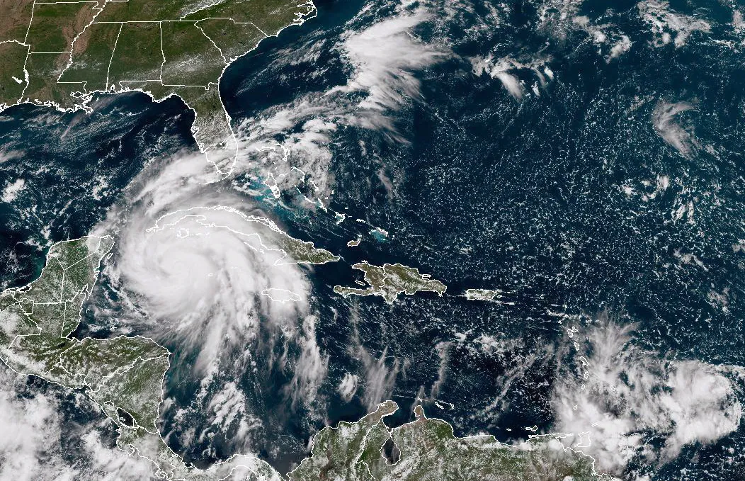
This brings us to the most critical, and often most ignored, paradox of the downgraded forecast: a reduction in the overall number of storms does not mean a reduction in risk per storm. In fact, it often concentrates the danger into specific, vulnerable corridors. AccuWeather has identified the northern and eastern Gulf Coast, along with the Carolinas, as regions facing a higher-than-historical-average risk of direct impacts, with the northeastern Caribbean also remaining on high alert. The reason for this geographical focus lies in the terrifying potential for rapid intensification. The presence of exceptionally warm waters near the U.S. coastline acts as an accelerant, capable of turning a disorganized tropical depression into a powerful, life-threatening hurricane in a matter of hours. DaSilva explicitly noted that these warm waters “can provide fuel for tropical systems that develop close to land, raising concerns about rapid intensification and leaving people and businesses with less time to prepare.” The history of hurricane forecasting is replete with examples of how a quiet season can produce an unforgettable monster. The haunting precedent is 1992, a year when the Atlantic was so inactive that only seven named storms formed. It was the very definition of a placid season. Then, Hurricane Andrew emerged. It exploded into a Category 5 behemoth before slamming into South Florida, leaving a swath of devastation that reshaped building codes, emergency management protocols, and the lives of thousands forever. Andrew was a single storm among seven, yet it accounted for nearly all the destruction and death of that entire year. The lesson is grim and enduring: a statistical outlier can define the reality of a season, and the difference between a quiet year and a catastrophic one can rest entirely on the path and intensity of just one system.
Placing this forecast into the context of the current timeline provides a clearer picture of where we stand. The Atlantic hurricane season officially began on June 1st and will run through November 30th, but the psychological and practical weight of the season is heavily concentrated in the late summer and early fall. As of mid-August, the Atlantic has only produced three named storms—Arthur, Bertha, and Cristobal—none of which posed a significant threat to the U.S. mainland. Historically, the first hurricane of the season typically forms around August 11th, and the fourth named storm by August 15th, meaning the current season is running behind these benchmarks—a statistical reflection of the heavy wind shear suppressing development. However, the most active portion of the season is still entirely ahead of us. The meteorological peak, around September 10th, represents the period when ocean temperatures have absorbed maximum summer heat and atmospheric conditions are most conducive for tropical formation, a moment of maximum tension for everyone watching the radar. The current lull, while encouraging to some, should not be mistaken for the end of the danger. The peak of the season is a period when a single, late-forming system can easily slip through a brief weakening of the wind shear. Berardelli warned of this window, stating that there will “still be short windows when shear weakens that will allow for some spin ups,” which means the quiet period is a fragile illusion. The hurricane season is a marathon, not a sprint, and the final months of October and November have historically produced some of the most impactful storms in U.S. history, such as Hurricane Sandy in 2012, which struck in late October. The forecasters are urging residents to understand that the worst is perhaps not over, but rather ahead of them, hiding within the very conditions designed to suppress them.
While the Atlantic Ocean is being actively muzzled by El Niño, the Pacific Ocean is being unleashed with ferocious intensity, demonstrating the interconnectedness of our global climate system. The islands of Hawaii are currently suffering the consequences of this powerful shift. They are still reeling from the devastating impact of Hurricane Lala, a system that, despite significantly weakening as it approached the islands, unleashed an extraordinary amount of moisture, resulting in over forty inches of rain in some areas. This torrential rainfall triggered catastrophic flash flooding, destructive mudslides, and the complete overwhelming of local infrastructure. Homes were damaged, roads and bridges were washed away, and power was knocked out for thousands of residents. The human toll has been heartbreaking, with the Associated Press reporting two deaths attributed to storm-related incidents, incidents that serve as a gut-wrenching reminder that even a weakening hurricane is still a lethal weapon of nature. Now, as these communities struggle to dig out, assess the damage, and begin the long road to recovery, meteorologists are closely monitoring yet another tropical system developing southeast of the island chain. The National Hurricane Center suggests this system could strengthen into a tropical depression in the coming days, presenting a formidable challenge to an already battered population. This is the ultimate expression of El Niño’s dual nature, a phenomenon that Berardelli described succinctly: “It juices up the Pacific and inhibits the Atlantic.” Hawaii is the physical embodiment of the former, a stark and tragic contrast to the relative calm in the Atlantic, and a reminder that while we worry about our own coastlines, the weather is also writing a story of destruction elsewhere in the country.
In the final analysis, this revised forecast serves as a profound lesson in the importance of nuance and preparedness in an era of climate uncertainty. It is tempting to look at the lowered numbers and breathe a sigh of relief, to assume that the threat has passed and that life can return to normal. But the experts, the men and women who have devoted their lives to understanding these complex atmospheric phenomena, are issuing a unified clarion call to resist this complacency. The forecast is a reminder that a quiet season is not a safe season. The unique combination of a record-strength El Niño suppressing development and exceptionally warm coastal waters primed for rapid intensification creates a scenario where the absence of storms is overshadowed by the potential for a single, explosive event. For residents along the Gulf Coast, the Carolinas, and the northeastern Caribbean, the preparedness checklist remains unchanged and urgent: review your insurance policies, solidify your emergency communication plans, know your evacuation zone, and assemble your disaster supply kits. The lowering of the storm count is not a dismissal of danger but a shift in the nature of the threat—from a worry about constant pressure to a more acute, targeted vigilance for a sudden, devastating strike. The 1992 season is the eternal warning that one storm can change the narrative of an entire year, and that even a historically inactive season can leave a community in rubble. So, as we approach the peak of the season around September 10th, we must heed the wisdom of the forecasters: we can allow ourselves a modicum of relief that the odds are improved, but we must not allow ourselves to be lulled into a state of inaction. The Atlantic may be quiet for now, but the silence is deceptive, and the ocean is never truly at rest. We must remain alert, prepared, and humble in the face of nature’s unpredictable, awe-inspiring power, understanding that safety lies not in the predictions, but in our persistent readiness to meet whatever the horizon may bring.