


For as long as most of us can remember, the proverb “All roads lead to Rome” has carried a sense of inevitable destination, as if the entire ancient world were somehow funneling toward one glorious city. It is a phrase that has shaped popular imagination for centuries, conjuring images of Roman legions marching along perfectly straight stone highways, merchants hauling goods across the Alps, and emperors dispatching messengers to the farthest corners of their dominion. But a sweeping new study of the Roman Empire’s vast road network suggests that this familiar saying, however poetic, is far from the whole truth. Published on September 15 in the journal Nature Communications, the study analyzed roughly 190,000 miles of Roman roads stretching across Europe, the Middle East, and North Africa. The research team, led by classical archaeologist Tom Brughmans of Aarhus University in Denmark, combined existing archaeological and historical data to create an entirely new map of the empire’s road network, then examined its structure on an unprecedented empire-wide scale. What they found challenges the intuitive picture of Rome as the unique gravitational center of overland travel. While Rome was undoubtedly a major hub, the empire’s road network was far more decentralized than the old proverb suggests. Provincial capitals, regional centers, and frontier cities all played essential roles in connecting the vast territories under Roman control. In fact, the study reveals that the road system was a complex web of overlapping connections, with many nodes of importance scattered across three continents. Rome was one of those nodes, but it was by no means the only one. The old saying, it seems, may have been doing more to flatter the city’s legacy than to describe the actual geography of the ancient world.
The most striking example of this unexpected centrality is Constantinople, the city now known as Istanbul in modern-day Turkey. After Emperor Constantine made it the new imperial capital in the fourth century AD, Constantinople emerged as a far more central hub for overland travel than Rome itself, according to the researchers. Its location, perched at the crossroads of Europe and Asia, gave it an extraordinary geographical advantage. Positioned along the natural corridor between the Balkan Peninsula and Anatolia, and controlling the sea route between the Mediterranean and the Black Sea, Constantinople became a kind of hinge for the entire empire. Travelers moving from the western provinces to the eastern frontiers, or from the wealthy cities of Syria and Egypt to the Danube River basin, would inevitably pass through or near this great metropolis. The study’s data suggest that Constantinople’s centrality in the road network was exceptional, reflecting not just its political status but also its position as a bridge between worlds. Brughmans, speaking about the findings, noted that the proverb “all roads lead to Rome” was medieval in origin, coined long after the Western Roman Empire had collapsed, and should not be taken literally. He pointed out, rather dryly, that none of the roads in Roman Britain actually led to Rome. “It is quite surprising how persistently this maxim has shaped popular understanding of Roman roads,” he said. “It’s fair to say our study complicates the proverb. I prefer to say, ‘All roads lead to Rome and everywhere else.’” That playful correction captures something important: the Roman road network was not a simple radial system centered on one city, but a sprawling, interconnected lattice that bound together an enormous and diverse empire. Roads led to many places, and every city of consequence was a destination in its own right.
Still, historians who study the Roman world caution that these findings should not be read as diminishing Rome’s importance. Taco Terpstra, a professor of history and classics at Northwestern University in Illinois, who was not involved in the research, told Fox News Digital that the study does not argue that Rome was irrelevant, nor should it be interpreted that way. Terpstra emphasized the importance of time period when thinking about the empire’s road network. Constantinople, he pointed out, “was only created as such in the fourth century. Before that, it was a sleepy fishing town called Byzantium. So, we have to be careful a little bit about what time period we’re looking at.” For centuries before Constantine’s bold decision to build a new capital on the shores of the Bosporus, Rome had been the undisputed heart of the empire. It was the seat of the emperor, the home of the Senate, and the largest city in the known Western world, with a population that may have reached one million inhabitants. Terpstra noted that the empire’s second-largest city, Alexandria in Egypt, was impressive in its own right but still dwarfed in comparison, with roughly half of Rome’s population. “Rome is the center of the empire. This is where power lies,” he said. “This is where the emperor is. This is where the Senate is. … [It was the] largest city in the empire, a million inhabitants.” For much of Roman history, if you wanted to find power, wealth, influence, or opportunity, you went to Rome. The city’s political, military, and ideological gravity was immense, and it radiated outward across the Mediterranean world. Yet once Constantinople was established, the eastern capital quickly attracted overland connectivity in a way that made it the practical center of travel for much of the empire. Terpstra acknowledged this transformation, saying, “Once Constantinople becomes de facto the capital of the empire, it is clear that it attracts a lot of overland connectivity.” The study’s emphasis on Constantinople, then, is not a rejection of Rome’s historical significance but rather a reminder that empires evolve, and so do their networks of movement and communication.
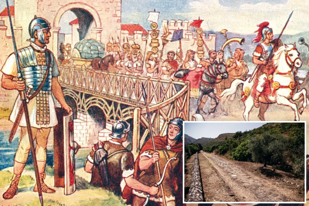
Beyond the debate over which city was the true hub, the study also turned its attention to one of the most celebrated achievements of Roman engineering: the remarkable straightness of Roman roads. Anyone who has ever looked at a map of the ancient world has been struck by the way Roman roads cut across landscapes in bold, unyielding lines, seemingly indifferent to hills, valleys, and other natural obstacles. The Romans were famous for building roads that were “about as straight as the Romans could make them,” as Terpstra put it, given the technology and surveying tools available at the time. But the study reveals that this straightness was not absolute. Difficult terrain often forced routes to deviate from a direct path, bending around mountains, marshlands, and other impassable features. The Romans were pragmatic engineers. They prized efficiency and speed, but they also understood that some landscapes simply could not be conquered by a perfectly straight line. Instead, they made their roads as direct as possible, then adjusted when necessary, creating a network that was both ambitious and realistic. The roads were originally built with a military purpose in mind. “The roads in the first instance, and it’s often forgotten, were military infrastructure,” Terpstra said. “These were in the first place, after the conquest, intended to move troops quickly.” When a Roman general conquered a new territory, one of the first priorities was to lay down roads that would allow legions to move rapidly through hostile terrain, reinforce garrisons, and suppress uprisings. Speed could mean the difference between victory and defeat, and the roads were designed to make sure that Roman military power could be projected wherever it was needed, as quickly as possible. Over time, however, these military highways took on an equally important economic role. Merchants, traders, travelers, and migrants all followed the legions, and the roads became the arteries of commerce and communication, linking cities, markets, and ports in a vast exchange of goods, ideas, and culture.
Yet for all the fame and durability of Roman roads, they were not the empire’s most important transportation network. That honor belonged to the sea. Terpstra emphasized that maritime transportation was far cheaper than overland transport when it came to moving goods, and the Roman Empire was, at its heart, a Mediterranean empire. “The main transportation network of the Roman Empire is maritime,” he said. “That is really where the major connectivity lies.” It is easy to forget, in our admiration for those magnificent stone highways, that shipping goods by sea was vastly more economical than hauling them over land. A single ship could carry a cargo that would require hundreds of oxcarts, and it could travel day and night without needing to stop for food, water, and rest. The Mediterranean Sea was the true superhighway of the ancient world, connecting Rome to the grain fields of Egypt, the olive groves of Spain, the wine-producing hills of Gaul, and the luxury markets of the East. Roads certainly played a crucial role in feeding the empire’s cities, moving troops, and facilitating local trade, but they were often the final link in a much longer journey that began on the water. This does not make the roads any less impressive. It simply places them in their proper context. The Roman road network was a remarkable achievement, a testament to the empire’s organizational genius and its ability to bind together diverse peoples and landscapes. But the Roman Empire was not built by roads alone. It was built by ships, by sailors, by winds and currents, by the countless merchants who risked their lives crossing the Mediterranean in every season. The roads were the skeleton of the empire; the sea was its lifeblood.
So what should we make of the old saying that all roads lead to Rome? Perhaps the truth is both simpler and more beautiful than the proverb suggests. The saying is not entirely wrong, if we understand it as a metaphor for Rome’s enduring legacy in Western civilization. Rome was, for centuries, the political and cultural heart of the known world, and its influence still shapes our laws, languages, architecture, and institutions. In that sense, all roads really did lead to Rome, because Rome was the destination that mattered most to millions of people living under its rule. But the new study reminds us that the Roman Empire was too vast, too diverse, and too dynamic to be reduced to a single point on a map. The road network was not a wheel with Rome at the center; it was a sprawling, living web that connected countless communities across three continents. Constantinople, with its privileged position between East and West, was a far more practical hub for overland travel after the fourth century. Provincial capitals and frontier towns were essential nodes in their own right, linking their regions to the wider empire. And beneath it all, the sea carried the bulk of the empire’s trade, binding the Mediterranean world together in ways that no road ever could. Perhaps the best way to honor the Roman achievement is not to cling to a medieval proverb, but to embrace Brughmans’s playful correction: all roads lead to Rome, and to everywhere else. The Roman Empire was a world of connections, of paths crossing and re-crossing, of people moving in every direction. Its roads led to cities, to temples, to markets, to forts, to ports, to the homes of ordinary men and women going about their daily lives. They led to Rome, yes, but they also led away from Rome, to the distant frontiers of Britain, the deserts of North Africa, the mountains of Anatolia, and the shores of the Red Sea. In the end, all roads lead to people, and people, then as now, were always going somewhere new.