






For residents of Davis, California, late May is typically a time of predictable warmth, dry breezes, and a gentle transition from spring into the hot, sun-drenched Sacramento Valley summer. On any ordinary Tuesday in this vibrant college town, life moves to the quiet rhythm of students cycling across the sprawling University of California, Davis campus and farmers tending to the rich agricultural lands of Yolo County. The day began with a comforting familiarity, characterized by temperatures lounging in the mid-70s under a clear blue sky that promised nothing but sunshine. However, the atmosphere had a dramatic and highly unusual plan in store. A slow-moving, moisture-heavy low-pressure system crept silently over Northern California, completely destabilizing the regional weather patterns. Almost without warning, the bright afternoon skies bruised into an intimidating charcoal grey, and the barometric pressure plummeted. What happened next felt like a scene from a dramatic film: a sudden, biting wind swept through the valley, and within minutes, the temperature plunged by more than twenty degrees, dropping from the cozy 70s down to a shivering high 40s. Pedestrians scrambled for cover, pulling light spring jackets tight against their bodies as the first giant, icy droplets of rain began to violently hammer against the dry pavement, signaling the arrival of a historic meteorological anomaly that would leave the community in absolute awe.
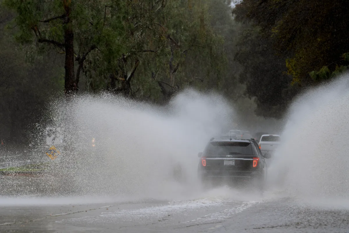
As the storm system settled directly over the city, the gentle spring shower instantly escalated into an extraordinary, howling torrent. The downpour was so sudden and intense that it resembled a tropical monsoon rather than a typical Northern California rainstorm. Street gutters, designed to handle the region’s moderate winter precipitation, were instantly overwhelmed, sending sheets of water cascading across roads and sidewalks. On local highways, particularly Interstate 80—the vital artery connecting the San Francisco Bay Area to Sacramento—drivers were forced to slow to a crawl, with hazard lights flashing, as windshield wipers struggled to keep pace with the blinding sheets of water. The sheer intensity of the storm caught even seasoned weather observers off guard. Extreme storm chaser Colin McCarthy, who has witnessed some of the planet’s most severe weather events, captured the chaos on video and shared it on social media, declaring it “one of the most insane” thunderstorms he had ever witnessed in the area. McCarthy’s footage showed visibility reduced to near zero as local weather apparatuses recorded nearly half an inch of rain falling in a mere five minutes—a rate of precipitation that turned backyards into temporary lakes and created a deafening roar that echoed through the flat, agricultural basin of the valley, leaving residents huddled indoors, staring out their windows in disbelief.
The sheer volume of water that fell during this brief window has left meteorologists and climate enthusiasts scrambling to comprehend the scale of the event. On average, the city of Davis receives a meager 0.73 inches of rainfall for the entire month of May, spread out over just a few scattered, light drizzly days. On this single Tuesday, however, the sky opened up to deliver nearly a month’s worth of rain in a fraction of an afternoon. Official National Weather Service measurements showed varying totals, with some areas of the city receiving 0.57 inches and others recording a lighter but still substantial 0.18 inches. Yet, it was the data from personal, localized home weather stations that painted an even more jaw-dropping picture of the storm’s localized fury. Three separate personal weather stations in Davis recorded an astonishing 0.94 to 1.05 inches of rain pouring down in a brief fifteen-minute window. If verified, this incredible intensity would qualify the deluge as an unofficial “1-in-1000-year” rain event. While the National Weather Service could not officially confirm those mind-boggling figures, they acknowledged that given the highly localized and volatile nature of summer-like thunderstorms, such intense bursts of rain are entirely within the realm of scientific possibility.
To understand why this storm was so profoundly shocking to the local population, one must look at the unique geography of Davis and the broader Yolo County region. Sitting just fifteen miles west of Sacramento, Davis is nestled within the flat and incredibly fertile Sacramento Valley. It is a region defined by its agricultural heritage, where fields of tomatoes, almonds, and wine grapes rely on a highly calculated and predictable cycle of hot, dry summers and wet winters. The city’s infrastructure, its open spaces, and its residents are deeply attuned to this Mediterranean climate, meaning that late-spring storms of this magnitude are simply not on the local radar. When a storm of this intensity hits, the flat terrain offers nowhere for the water to easily drain, leading to rapid runoff, localized urban flooding, and extremely slick, hazardous road conditions. For the farmers whose crops are highly sensitive to sudden, heavy moisture at this stage of the growing season, and for the everyday residents who were preparing their homes for summer air conditioning rather than flood defense, the storm served as a stark, visceral reminder of how vulnerable our highly structured human landscapes can be to the sudden, chaotic whims of nature.
Providing context to this bizarre weather anomaly, National Weather Service meteorologist Katrina Hand explained that experiencing such heavy, concentrated rain is incredibly rare as Northern California moves toward the cusp of summer. In this part of the Golden State, the winter months are firmly established as the traditional “wet season,” a time when the region gathers the vast majority of its annual water supply to feed reservoirs and snowpacks. By the time May rolls around, the atmosphere typically transitions into a stable, dry pattern, making Tuesday’s moisture-laden, slow-moving low-pressure system a true atmospheric outlier. Hand pointed out that the localized nature of the storm meant that while one neighborhood in Davis felt like it was sitting directly under a waterfall, another just a few miles away might have only experienced a brief, mild wetting of the ground. This highly scattered behavior is characteristic of convective thunderstorms, where the most intense “core” of the precipitation can dump massive amounts of water over an incredibly narrow footprint, explaining why the official airport and municipal sensors might record moderate totals while residential backyards just a mile down the road are completely underwater.
As Davis residents dry out their carpets, sweep away organic debris, and assess the minor flooding around their properties, the atmosphere remains notably restless. The National Weather Service in Sacramento has kept the community on high alert, warning that the threat of isolated, volatile thunderstorms continues to linger across the forecast region. With unstable air remaining trapped in the valley, meteorologists have cautioned that any subsequent storm fronts could bring not only additional brief bouts of heavy rain, but also the hazards of frequent lightning, destructive hail, gusty winds, and even atmospheric anomalies like funnel clouds or weak, sporadic tornadoes. This lingering threat has left local residents keeping a watchful and anxious eye on the horizon, checking weather apps and listening to the sky with renewed respect. Ultimately, this extraordinary May deluge has done more than just water the local lawns; it has fundamentally challenged the local understanding of seasonal boundaries, reminding the people of Davis that even in a region famous for its predictable sunshine and dry summer heat, the skies still hold the power to completely rewrite the record books in a matter of minutes.