



The Colorado River is more than a waterway—it is the beating heart of the American Southwest, an ancient ribbon of snowmelt and sediment that has been stretched, strained, and fought over for more than a century. It waters alfalfa fields and lettuce rows, fills the taps of Phoenix and Las Vegas, cools the turbines of massive hydroelectric dams, and sustains ecosystems and indigenous communities that have lived along its banks since time immemorial. But after decades of relentless drought and ever-growing demand, that heart is faltering. The federal government has now stepped in with a decisive, and for some painful, new plan. The Department of the Interior has finalized operating guidelines for 2027 and 2028 that will force reductions in Colorado River deliveries to Arizona, California, and Nevada—a combined cut of 1.25 million acre-feet of water per year. It is a number that sounds clinical, but in reality it represents fallowed fields, tightened city water budgets, and hard choices for millions of people who rarely stop to think about where their water comes from. The goal, officials say, is to protect the river system itself, keeping critical reservoirs and infrastructure operational as drought and climate change continue to push water levels toward dangerously low marks.
For the Lower Basin states, the reductions are not evenly distributed, and the burden is considerable. If the water-sharing agreement proposed by these states earlier this year is implemented as expected, Arizona will bear the heaviest load, losing roughly 760,000 acre-feet per year. To put that in perspective, an acre-foot of water is enough to cover one acre of land one foot deep—about 326,000 gallons—and generally sufficient to meet the needs of one or two households for a year. Arizona’s cut amounts to about 27.1 percent of its basic 2.8 million acre-foot apportionment from the river. California, which holds the largest single allocation at 4.4 million acre-feet, will lose about 440,000 acre-feet per year, approximately 10 percent of its entitlement. Nevada, with a much smaller 300,000 acre-foot apportionment, will give up 50,000 acre-feet annually—about 16.7 percent of its share. Together, these reductions reach the 1.25 million acre-foot threshold for each of the next two years. On top of that, the Interior Department is asking for at least another 700,000 acre-feet of voluntary conservation and storage across the Lower Basin during the same period. These are not abstract numbers. They mean that some farmers in Arizona will have to decide which fields to water and which to leave dry. They mean that golf courses and lawns in the desert may look different. They mean that city water managers, who have long planned for growth, will have to work harder and think further ahead. The era of assuming the river will always provide is over.
The four Upper Basin states—Colorado, New Mexico, Utah, and Wyoming—will not face similar mandatory cuts under the new 2027-2028 guidelines, but that does not mean they are off the hook. Their relationship with the river is different: they supply much of its headwaters, and their water rights are tied to the snowpack that piles up in the Rocky Mountains each winter. Instead of ordering reductions, the Interior Department is asking these states to enter into an agreement that would allow water stored in federal reservoirs to be used more flexibly to protect Glen Canyon Dam and Lake Powell. Specifically, Colorado, New Mexico, Utah, and Wyoming are being encouraged to work with the Lower Basin states and tribal governments on coordinated management of the Aspinall, Flaming Gorge, and Navajo reservoir systems. This cooperative approach recognizes that a crisis upstream can become a catastrophe downstream. Secretary of the Interior Doug Burgum framed the plan in terms of shared responsibility and interdependence. “We are grateful for the Seven Basin States, the thirty Basin Tribes, Mexico, and many other basin stakeholders who have provided the feedback and voluntary arrangements necessary for the development of the 2027-2028 Operating Guidelines,” he said. “Forty million people, millions of acres of farmland and ranchland, industries that power the American West, and some of our nation’s fastest growing metropolitan areas depend on the Colorado River.” Those words carry weight, especially when you consider that the river also crosses an international border, sustaining agriculture and communities in Mexico. The challenge is not just about allocating scarcity; it is about doing so in a way that respects history, law, culture, and the plain reality that everyone is in this together.
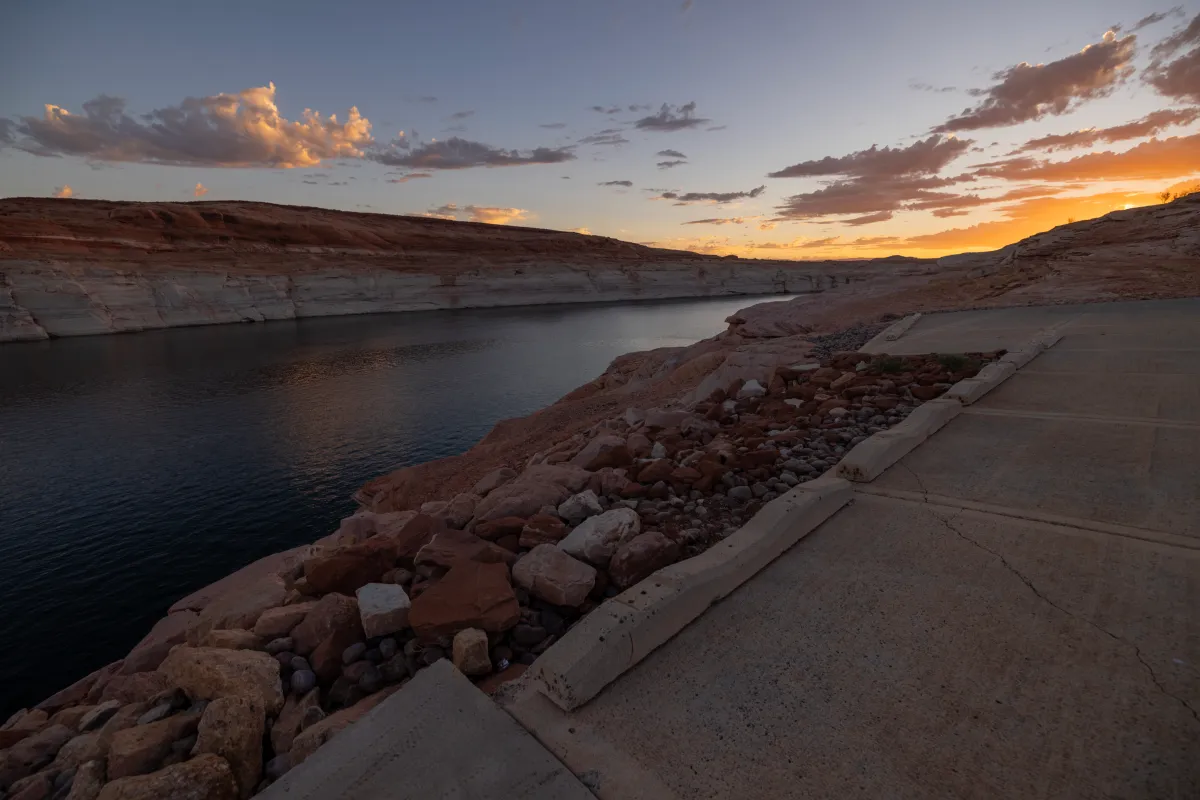
Lake Powell, the immense reservoir stradling the Arizona-Utah border, has become the symbol of the river’s distress. Along with Lake Mead, it has suffered a dramatic decline, its shimmering bathtub rings of minerals telling a stark story of evaporation and overuse. Under the new operating guidelines, Lake Powell is expected to begin the 2027 water year at an elevation somewhere between 3,540 and 3,510 feet. Officials plan to limit releases from the reservoir to an initial range of 6 million to 7 million acre-feet per year, with the explicit aim of keeping the water surface at or above 3,510 feet. This matters enormously because Glen Canyon Dam, which created Lake Powell, is not just a piece of concrete—it is a critical source of hydroelectric power for six Western states. The electricity it generates flows into homes, hospitals, schools, and businesses, providing reliable, relatively clean power to millions of people. When reservoir levels drop too low, the turbines can become less efficient or even unusable, threatening the grid and forcing utilities to seek expensive alternatives. The new rules are designed to protect the dam’s ability to generate electricity while still allowing water to pass downstream to communities, farms, and the river’s ecosystems. But it is a delicate balancing act. Water stored in Lake Powell is also a reserve for future drought years, and releasing too much today could leave tomorrow with nothing. Water managers are essentially walking a tightrope, trying to preserve a vital source of power and water without draining the bank accounts of the West.
Lake Mead, the largest reservoir in the United States by capacity, is in similarly dire straits. Years of drought, rising temperatures, and heavy demand have pushed it to historically low levels, exposing old docks, sunken boats, and even more ominous signs of a system under stress. The Interior Department noted that the combined contents of Lake Powell and Lake Mead have not been this low since before Lake Powell began filling after Glen Canyon Dam was completed in the 1960s. That is a sobering statement—one that makes clear just how much the river’s enormous plumbing system has been depleted in a relatively short span of time. The new guidelines attempt to address this by reducing Lower Basin deliveries through Lake Mead by 1.25 million acre-feet in 2027, giving federal officials the tools to respond if reservoir levels continue to fall. And the cuts could get bigger. Yes, the 1.25 million acre-feet annual reduction applies only to the first two years of the new operating framework. If water conditions worsen, additional reductions could be imposed in subsequent years. The broader 10-year framework allows the operating guidelines to be adjusted every two years, providing flexibility to respond to changing reservoir levels, drought conditions, and the ongoing negotiations between states. The plan also arrives in the wake of a significant failure: the seven Colorado River Basin states could not agree on a replacement for the rules that expire at the end of 2026. That inability to reach consensus forced the federal government to act, underscoring how difficult it is to find common ground when everyone is competing for the same shrinking resource.
Looking ahead, the new guidelines will apply to the 2027 and 2028 operating years, but the larger battle over the river’s future is far from over. Longer-term negotiations continue, and the Interior Department has said it will prioritize voluntary agreements and cooperation between states, tribes, and Mexico—while still preserving its authority to impose solutions if conditions worsen. For now, Arizona, California, and Nevada face specific, defined reductions, while Colorado, New Mexico, Utah, and Wyoming are being urged to develop measures that could help protect Lake Powell and Glen Canyon Dam. The stakes could not be higher. The Colorado River supports tens of millions of people, millions of acres of farmland, and major electricity infrastructure across the Southwest. It is woven into the identity of the region, from the Grand Canyon to the farms of the Imperial Valley to the high-country ski towns that depend on Rocky Mountain snowfall. This new plan is not a permanent answer; it is a pause, a managed retreat, an attempt to slow the bleeding while bigger decisions are made. But it also represents a moment of reckoning. The river is telling us that the old rules no longer work. The weather has changed, the population has grown, and the water is simply not there in the amounts we once believed it would be. The question is whether the people who depend on that water can learn to live within its limits—together, fairly, and with an eye toward the future. In the end, the Colorado River is not just a resource to be divided. It is a shared inheritance, and the choices made in the next few years will echo for generations.