





Landslides and Inequality: The Unequal Burden of America’s Hidden Hazard
Landslides represent one of America’s most costly and deadly natural hazards, causing billions of dollars in damage and claiming dozens of lives annually across the nation. Yet a groundbreaking new study reveals that the burden of this geological threat falls heaviest on those least equipped to handle it. Published on July 29 in the journal Earth’s Future, this research marks one of the first attempts to systematically examine the socioeconomic dimensions of landslide exposure in the United States, uncovering troubling patterns of inequality that have largely gone unrecognized until now. The study paints a stark portrait of how poverty and geological vulnerability intersect, particularly in the Appalachian region, where the steep terrain that creates landslide risk also tends to concentrate communities with limited economic resources and fewer options for relocation or hazard mitigation. The findings underscore a fundamental injustice: those who can least afford to prepare for or recover from landslide disasters are precisely the ones most likely to experience them.
The research methodology represents a significant advancement in understanding landslide risk, according to Ben Mirus, a geologist with the U.S. Geological Survey who led the agency’s 2024 landslide mapping effort but was not involved in this study. Mirus emphasized that the new approach goes beyond simply identifying where landslides are likely to occur, adding crucial context about why these locations matter and who they affect. The team analyzed landslide susceptibility, ranging from high likelihood to low probability, and then overlaid these hazard maps with data about homes and infrastructure, ultimately assessing the socioeconomic characteristics of affected areas. This comprehensive approach revealed that at least 6.5 million Americans currently live with high landslide risk, a figure that the researchers describe as conservative. When medium-risk areas are included in the calculation, the numbers swell by millions more, corroborating earlier estimates from the U.S. Geological Survey. Joe Wartman, a geotechnical engineer at the University of Washington, noted that landslide stories exist throughout the United States, but the highest risk occurs in regions that combine dense human populations with steep terrain, creating what he called a “perfect storm” of vulnerability.
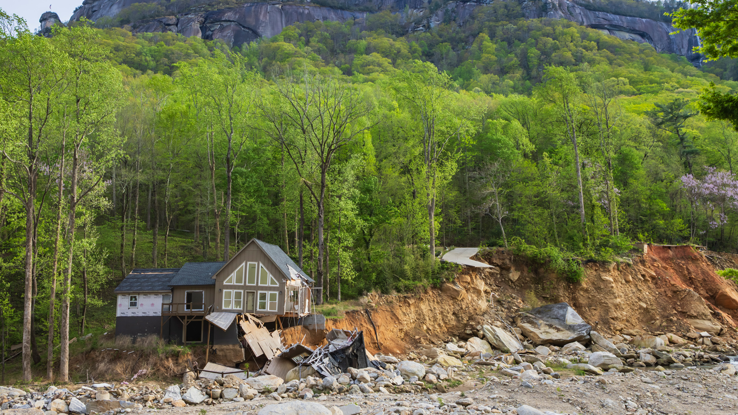
The Appalachian region emerges as the study’s most troubling hotspot, with findings that Wartman described as “grim.” At least 3.6 million people in Appalachia live in landslide-prone areas, representing a staggering 55 percent of the national total of landslide-exposed individuals. This concentration is particularly concerning because the region’s landslide risk coincides with high densities of lower-income residents who lack the financial resources to move away from danger or implement protective measures. The geography of Appalachia creates an especially challenging situation: its steeply walled valleys, made lush by abundant rainfall, force communities to choose between building homes on unstable slopes or in valley floors where the accumulated rocks, mud, and debris from landslides inevitably cascade down. West Virginia exemplifies the problem with troubling clarity—an astounding 20 percent of its population resides in high-risk areas, compared to a national average of just 2 percent. The study’s findings suggest that for many Appalachian residents, landslide risk is not simply an abstract threat but a persistent feature of daily life, bound up with economic constraints that make the choice to remain in dangerous areas feel like the only viable option.
In stark contrast, the study reveals a very different socioeconomic profile in western landslide hotspots. Residents of cities located in high-risk zones on the West Coast are more often wealthy, with communities in Los Angeles and Seattle representing many of the at least 1.7 million people living with high landslide risk in mountainous western regions. These populations typically have greater access to engineering solutions that can reduce landslide risk, such as retaining walls, drainage systems, and slope stabilization projects. They also possess the financial resources to relocate or rebuild after disasters strike, creating a fundamental disparity in resilience between wealthy and poor communities facing similar geological threats. Mirus called this socioeconomic dimension a “really important advance” in understanding landslide hazards, noting that after mapping where landslides occur, the crucial next question is understanding why and where they matter most. The disparity highlights how natural hazards, while geologically impartial, produce profoundly unequal outcomes when filtered through the lens of economic inequality, with wealth serving as a buffer against the worst consequences of living in hazardous terrain.
The political landscape surrounding landslide mapping adds another layer of complexity to addressing these risks. Despite the demonstrated utility of such maps in protecting public safety, they face opposition from some property owners and industries concerned about potential drops in property values. This resistance can have real consequences, as demonstrated in North Carolina, where lobbying efforts successfully halted the state’s landslide mapping program in 2011. The program remained inactive for six years, and geologists were still catching up on the lost time when Hurricane Helene struck in 2024, triggering more than 9,400 landslides, mostly in the state. Similar pushback has emerged more recently from homeowners in Juneau and Sitka, Alaska, although Mirus noted there is little evidence supporting concerns about landslides impacting property values. Wartman emphasized the importance of continuing federal and state mapping efforts despite these challenges, arguing that the new comprehensive maps provide an extraordinary ability to focus resources on those most in danger. The conflict between short-term economic concerns and long-term public safety reflects a broader tension in hazard management, where anticipating and preventing disasters competes with immediate financial interests.
The implications of this research extend beyond academic interest, pointing toward the need for targeted interventions that address both physical and economic vulnerability. Wartman acknowledged the immense difficulty of mitigating and managing landslide hazards across the vast terrain of the United States, where the sheer scale of the problem defies simple solutions. However, the new mapping capabilities offer hope for hyper-localized focus on the communities most at risk, enabling more efficient allocation of limited resources. The challenge of mitigating landslide risk is particularly acute in Appalachia, where the combination of mountainous terrain, aging infrastructure, and economic constraints creates persistent vulnerability that cannot be addressed through geological engineering alone. Addressing this inequality likely requires multifaceted approaches that combine improved hazard mapping with economic development, affordable housing policies, and infrastructure investments that recognize the interconnected nature of social and geological vulnerability. The study’s findings suggest that investment in landslide resilience must be coupled with broader efforts to address poverty and economic opportunity, particularly in regions where residents face the impossible choice between staying in dangerous areas and leaving their homes and communities behind.
Looking forward, researchers express hope that continued landslide mapping efforts will improve public safety for individuals and communities across the nation. The more information that is available about landslide hazards, Mirus argues, the better decisions people can make about where to live, how to prepare, and when to evacuate. This knowledge becomes particularly valuable as climate change potentially increases the frequency and severity of landslide-triggering events like intense rainfall. The study’s integration of geological and socioeconomic data represents an important step toward understanding natural hazards not merely as physical phenomena but as social problems requiring comprehensive solutions. By revealing who bears the greatest burden of landslide risk, the research provides a foundation for more equitable hazard management policies and resource allocation. As the United States continues to grapple with the increasing costs of natural disasters, understanding the intersection of geological hazards and human vulnerability becomes ever more critical, especially for the disadvantaged communities who face the compounding challenges of poverty, hazard exposure, and limited capacity to adapt or recover. The study ultimately serves as a call to action, urging policymakers to recognize that effective disaster risk reduction cannot be achieved without addressing the underlying social and economic inequalities that make some Americans far more vulnerable to nature’s destructive forces than others.