

Newly obtained federal contracting documents show that the Trump administration has drawn up plans for nearly 70 miles of secondary border barriers in the remote Big Bend region of West Texas, a stretch of desert, mountains and river canyons that has long been known more for its wild landscape than for heavy border enforcement. Newsweek obtained the records through the Freedom of Information Act, and Laiken Jordahl, a conservation advocate with the Center for Biological Diversity, first shared them on X on Wednesday. The documents give a more detailed picture of construction specifications than the government had previously made public. One document says the project “consists of approximately 68.2 miles of secondary barrier.” Another requires contractors to install poles equipped for infrared illumination and white lighting, along with wiring, fiber-optic cable and camera equipment. Jordahl told Newsweek that U.S. Customs and Border Protection “appears to be planning, or to have previously planned, nearly 70 miles of secondary barrier in BBT-2, a fact that has not been previously disclosed or reported.” The records are heavily redacted, making it difficult to determine exactly which contracts are included, but Jordahl said he believes they cover BBT-2—the section running through Presidio and Big Bend Ranch State Park—and possibly some parts of BBT-4. The documents also say that “all vertical barriers are considered secondary barrier throughout the scope” of that portion of the project. Newsweek contacted CBP for comment on Thursday.
To understand why this matters, it helps to picture the Big Bend Border Patrol Sector itself. It covers roughly 517 miles and includes Big Bend National Park, Big Bend Ranch State Park and vast stretches of public and private land along the Rio Grande. This is a sparsely populated landscape of desert, mountains and river canyons, and it has historically recorded fewer migrant apprehensions than other parts of the southern border. According to CBP data, apprehensions in the sector peaked at 37,266 in fiscal year 2021, then fell to 31,948 in 2022, 11,823 in 2023, 4,921 in 2024 and 3,096 in 2025—a decline of about 92 percent from the 2021 peak. Those figures cover the entire 517-mile sector, not just Big Bend National Park, and they count people apprehended by agents rather than all attempted crossings, meaning they do not capture people who evade detection. The administration has cited more than 89,000 apprehensions between fiscal years 2021 and 2025 in describing the sector as an area of “high illegal entry,” even though the sector had the fewest migrant apprehensions, both overall and per border mile, of any Border Patrol sector. For people who live in or visit the region, the numbers and the landscape are not abstract: they are part of a quiet, rural area where border policy, public land, tourism and local communities are closely intertwined.
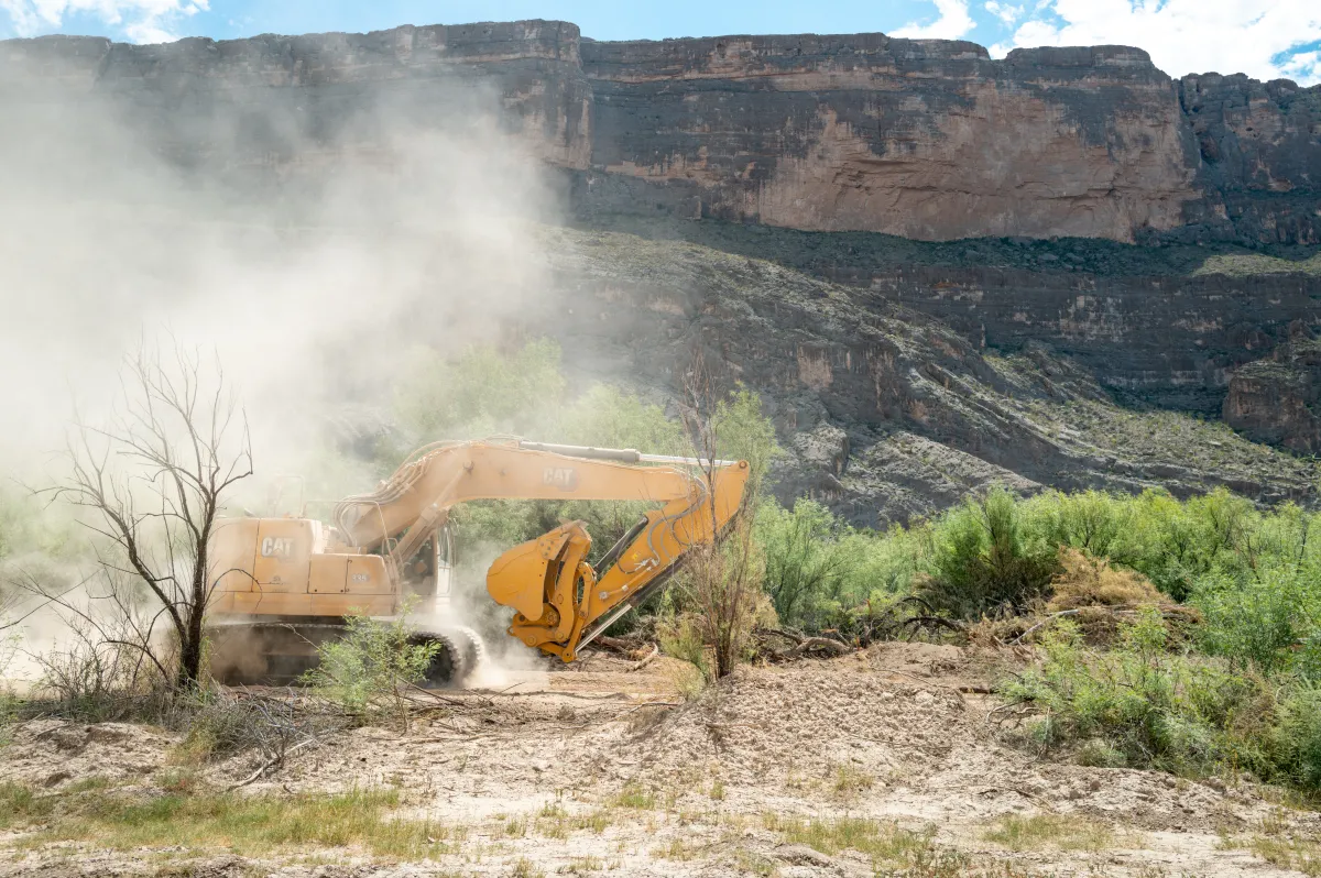
The newly disclosed documents are only one piece of a much broader construction push. The Trump administration is moving forward with plans for walls, vehicle barriers, roads and surveillance systems across the Big Bend region. In February, CBP proposed about 175 miles of primary border barrier in Hudspeth, Jeff Davis and Presidio Counties, with lighting, cameras, fiber-optic cable and patrol roads. In June, the agency proposed 17 miles of 4- to 6-foot vehicle barriers and about 205 miles of roads in Brewster County. A July proposal called for another 157 miles of vehicle barriers across Brewster, Terrell and Val Verde Counties. The documents obtained by Newsweek add detail about the surveillance network intended to provide round-the-clock coverage along parts of the border. One camera specification says, “The purpose of the CCTV system is to provide 24/7 surveillance of the enforcement zone.” The system would include motion detection and cameras positioned to eliminate blind spots. Contractors are instructed to position poles so that cameras have “a continuous view of the Rio Grande,” although the spacing between the poles is redacted. In plain terms, the plan is not just a physical barrier but a layered system of lights, cameras, cables and sensors designed to watch the border continuously.
The documents also reveal engineering details that could have real consequences for people and property. For drainage, they say, “All local drainage crossings within vertical barrier segments shall be completely closed off” by a vertical barrier or one fitted with rotating drainage gates. Smaller culverts would have grates installed on the river side, while larger ones would use rotating gates. Jordahl warned that such structures could trap debris and worsen flooding. “This could cause catastrophic flooding as debris could clog gates, causing floodwaters to back up into communities like Presidio,” he said. That concern is especially serious in a region where river canyons and desert terrain can channel water quickly during storms. The documents also include a provision addressing wildlife, saying that tree and brush removal in threatened and endangered species habitat “will be minimized” and “will not interfere with active nesting as per the Migratory Bird Treaty Act.” Even so, the combination of barriers, roads, lighting and surveillance raises questions about how much disturbance the landscape can absorb, and how carefully the government will balance border security with environmental protection in a place that is home to sensitive species and fragile habitats.
The construction push followed an executive order signed by Trump on January 20, 2025, directing the government to build physical barriers and pursue “complete operational control” of the southern border. In 2026, the Department of Homeland Security issued a series of waivers allowing border projects in the Big Bend region to proceed without complying with numerous environmental and historic-preservation laws. One waiver said the secretary had determined the area was one of “high illegal entry.” The construction soon became the subject of a legal fight. In August, CBP paused “all construction activity” inside Big Bend National Park while Commissioner Rodney Scott conducted a review. On October 2, Judge Kathleen Cardone of the Federal District Court for the Western District of Texas blocked barrier construction and other ground-disturbing work across the Big Bend Sector. In her subsequent opinion, Cardone found that the challengers were likely to succeed in arguing that the administration had exceeded its authority to waive federal laws. The Justice Department asked the Supreme Court on October 21 to lift the injunction while the case proceeds. That legal back-and-forth means the future of the project is still uncertain, even as the contracting documents show how far the planning has gone.
Taken together, the records paint a picture of a border project that is far more extensive and sophisticated than a simple line of fencing. It would combine secondary barriers, primary barriers, vehicle barriers, patrol roads, lighting, fiber-optic cable, cameras and motion detection across a remote and environmentally sensitive part of Texas. For conservationists like Jordahl, the redactions and the scale of the plans are troubling, especially because the documents suggest nearly 70 miles of secondary barrier in BBT-2 that had not been previously disclosed or reported. For local communities, the drainage provisions raise fears about flooding, while the wildlife provisions raise questions about how much habitat disturbance will be allowed. For the government, the project is framed as part of a broader effort to achieve operational control of the southern border. The documents do not settle those debates, but they do make the stakes clearer: what happens in Big Bend will affect not only border enforcement but also the people, parks, rivers and wildlife of one of the most remote corners of Texas. CBP has not yet responded to Newsweek’s request for comment, and the legal case over the waivers and construction remains active.