



Nature is throwing another curveball at the eastern half of the country as a relentless weather system prepares to drench millions of residents. Following a chaotic start to the week marked by severe storms and sudden flash flood warnings across the Upper Midwest, a heavy-handed cold front is slowly making its journey southeast. As this sluggish boundary creeps along, it is poised to become a major trigger for widespread showers and intense thunderstorms stretching from the Heartland all the way to the Northeast. For local residents, this means keeping close tabs on the sky as daily routines are likely to be disrupted by a sudden return of dark, churning clouds.
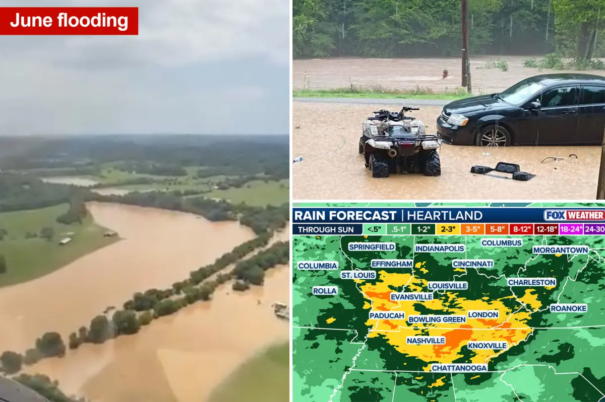
This slow-moving weather system brings a renewed threat of flooding to approximately 30 million Americans living in its path. The timing could not be worse for communities throughout the Ohio and Tennessee valleys, which are still drying out from the historic, torrential downpours that closed out the month of June. Because the ground in these areas is already completely saturated, the soil simply cannot absorb any more water, turning even moderate rainfall into an immediate hazard. As stronger, warm, moisture-laden winds blow in from the south to feed the advancing front, storm activity will pick up speed, blossoming over the Mississippi Valley before expanding eastwards to cover the Ohio and Tennessee valleys.
The primary danger over the coming days stems from a meteorological phenomenon known as “training” thunderstorms, where multiple rounds of heavy rain repeatedly path over the exact same neighborhoods like railroad cars on a track. Powered by high atmospheric instability and an abundant supply of tropical moisture, these storms will have no trouble dumping massive amounts of water in incredibly short periods. Recognizing this danger, forecasters have issued a Level 2 out of 4 risk for excessive rainfall on Thursday across parts of the Mississippi River Valley, focusing on western Kentucky, southern Illinois, and eastern Missouri. By Friday, this threat zone shifts slightly eastward, blanketing communities across southwestern Pennsylvania, Ohio, Kentucky, Missouri, Tennessee, and West Virginia through the weekend.
The situation is being monitored closely by meteorological experts who warn that conditions could easily deteriorate. According to the FOX Forecast Center, there is a strong possibility that Friday’s warning could be upgraded to a highly serious Level 3 out of 4 risk if the slow-moving storms continue to lock onto the same vulnerable locations. This persistent pattern means that flash flood threats will not just be a weekend worry, but will actually linger well into next week as the front continues its lazy, dragging journey further south and east, offering very little immediate relief to anxious residents.
Looking at the digital rain gauges, meteorologists expect broad rainfall totals of 1 to 2 inches to stretch from southern and central Missouri all the way eastward into West Virginia and northern Tennessee. More concentrated bullseyes of 3 inches are anticipated across southern Indiana, Kentucky, and Tennessee, with localized sweet spots easily topping 3 to 5 inches where the heaviest downpours stall. In places like Kentucky, where extreme Flash Flood Emergencies were declared just a short while ago, these numbers are deeply concerning, as any additional water will immediately pool on the surface, swelling local creeks, overflowing storm drains, and threatening homes.
Fortunately, there is a light at the end of the tunnel, especially for those living further north. While the tail end of this sluggish front will bring some scattered showers and rumbling thunderstorms to the Northeast, the region is expected to escape the worst of the deluge, with most of the wet weather concentrated on Friday. Behind the front, a welcome area of high pressure will push in, sweeping away the humidity and gray skies. By Saturday evening and Sunday, residents across the Northeast can look forward to the return of bright sunshine, drier air, and a beautiful summer weekend to help brush off the storm-weary blues.