


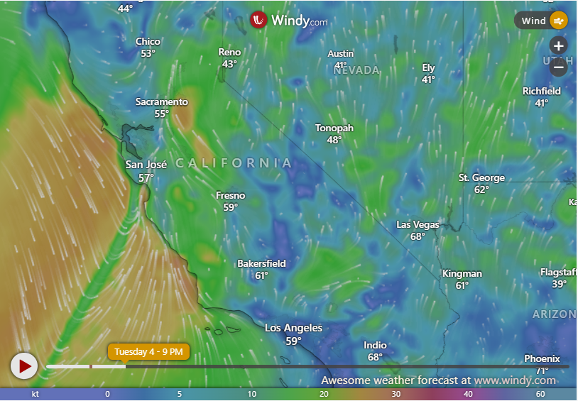
California is currently battling a significant wind event, with powerful gusts reaching up to 60 mph sweeping across various regions. The National Weather Service (NWS) has responded by issuing numerous wind advisories and warnings for affected counties, emphasizing the potential for hazardous conditions. The primary concerns stem from the combined effect of strong winds and dry vegetation, creating a heightened risk of wildfires, power outages, and dangerous travel conditions. The NWS has specifically warned of the potential for unsecured objects to become airborne projectiles, tree damage leading to downed power lines and blocked roadways, and difficulties for high-profile vehicles navigating the strong gusts. The recent wildfires in the Los Angeles region were exacerbated by similar wind conditions, underscoring the seriousness of the current situation.
The impact of these strong winds is widespread, affecting both coastal and inland communities. The NWS has issued a complex tapestry of alerts, encompassing wind advisories and high wind warnings, tailored to the specific risks in different regions. These alerts, beginning on Tuesday, February 4, 2025, and expected to persist through early Wednesday, cover a wide geographic area including the Central Coast, Ventura County Mountains, Antelope Valley, and portions of the Bay Area. The advisories warn of hazardous conditions capable of downing trees, causing power outages, and disrupting travel. The NWS has also reported significantly higher gusts in certain areas, with some locations experiencing peak winds approaching 100 mph, indicating the intensity of this weather event.
The varying levels of alerts issued by the NWS reflect the localized nature of the wind threat. Wind advisories are in effect for areas such as San Luis Obispo County Beaches, the Santa Lucia Mountains, and the Southern Salinas Valley, cautioning residents of strong winds that could create hazardous conditions. More severe high wind warnings, indicating the potential for significantly stronger gusts, have been issued for regions including the Northern Ventura County Mountains, San Luis Obispo County Mountains, and Santa Barbara County Interior Mountains. Further illustrating the complexity of the situation, additional wind advisories cover areas such as the Cuyama Valley, Southern Ventura County Mountains, and parts of the San Gabriel Mountains. This multi-layered approach to warnings allows the NWS to communicate specific risks to individual communities, facilitating targeted preparedness measures.
The detailed geographical breakdown of the affected regions highlights the wide-ranging impact of this windstorm. San Luis Obispo County experiences a dual threat, with beaches under a wind advisory and the mountainous regions facing a high wind warning. Ventura County similarly faces a varied threat level, with the northern mountains under a high wind warning while the southern mountains are under a less severe wind advisory. Santa Barbara County’s interior mountains also face a high wind warning, indicating a significant risk of strong, potentially damaging winds. These distinctions underscore the importance of residents paying close attention to the specific warnings issued for their location.
The NWS and other agencies are leveraging various communication channels to disseminate critical information to the public. The NWS Bay Area office, for example, utilized X (formerly Twitter) to inform residents about the ongoing wind advisory and its associated risks, including downed trees and power outages. These real-time updates are crucial for keeping the public informed and enabling them to take appropriate safety precautions. The information emphasizes the combination of strong winds and moist soil, highlighting the increased risk of trees being uprooted due to the weakened ground conditions.
In response to the ongoing threat, the NWS is urging residents in affected areas to take proactive safety measures. Securing loose objects that could become airborne in the high winds is paramount to preventing property damage and potential injuries. Avoiding unnecessary travel is also strongly advised to minimize exposure to hazardous road conditions, such as fallen trees or debris. Preparing for potential power outages is another crucial step, ensuring individuals have alternative power sources and essential supplies readily available. Finally, the NWS is emphasizing the continued high fire danger, particularly in areas experiencing a combination of low humidity and strong winds. This combination creates an environment ripe for rapid wildfire spread, underscoring the need for extreme caution and preparedness. Authorities will continue to monitor the situation closely, providing updates and implementing emergency measures as needed. The storm is predicted to peak between late Tuesday and early Wednesday, with conditions gradually improving by midday Wednesday. However, the NWS cautions that lingering gusts and persistent dry conditions may prolong the risk of fire and other wind-related hazards throughout the state.


