AI for Earth: The Allen Institute’s New Platform Democratizes Environmental Monitoring
In a significant advancement for environmental science and conservation, the Allen Institute for Artificial Intelligence (Ai2) has unveiled OlmoEarth, an open-access platform designed to revolutionize how organizations monitor and analyze our planet’s changing conditions. Announced on November 4, 2025, this comprehensive system leverages artificial intelligence to analyze satellite and sensor data, providing near real-time insights into critical environmental challenges. What makes OlmoEarth particularly groundbreaking is its accessibility—it empowers organizations without deep AI expertise to perform sophisticated environmental monitoring that was previously available only to well-funded research labs or through expensive proprietary systems. The platform represents a democratization of Earth observation technology, potentially transforming how we track deforestation, assess agricultural health, predict wildfire risks, and respond to other environmental changes across the globe.
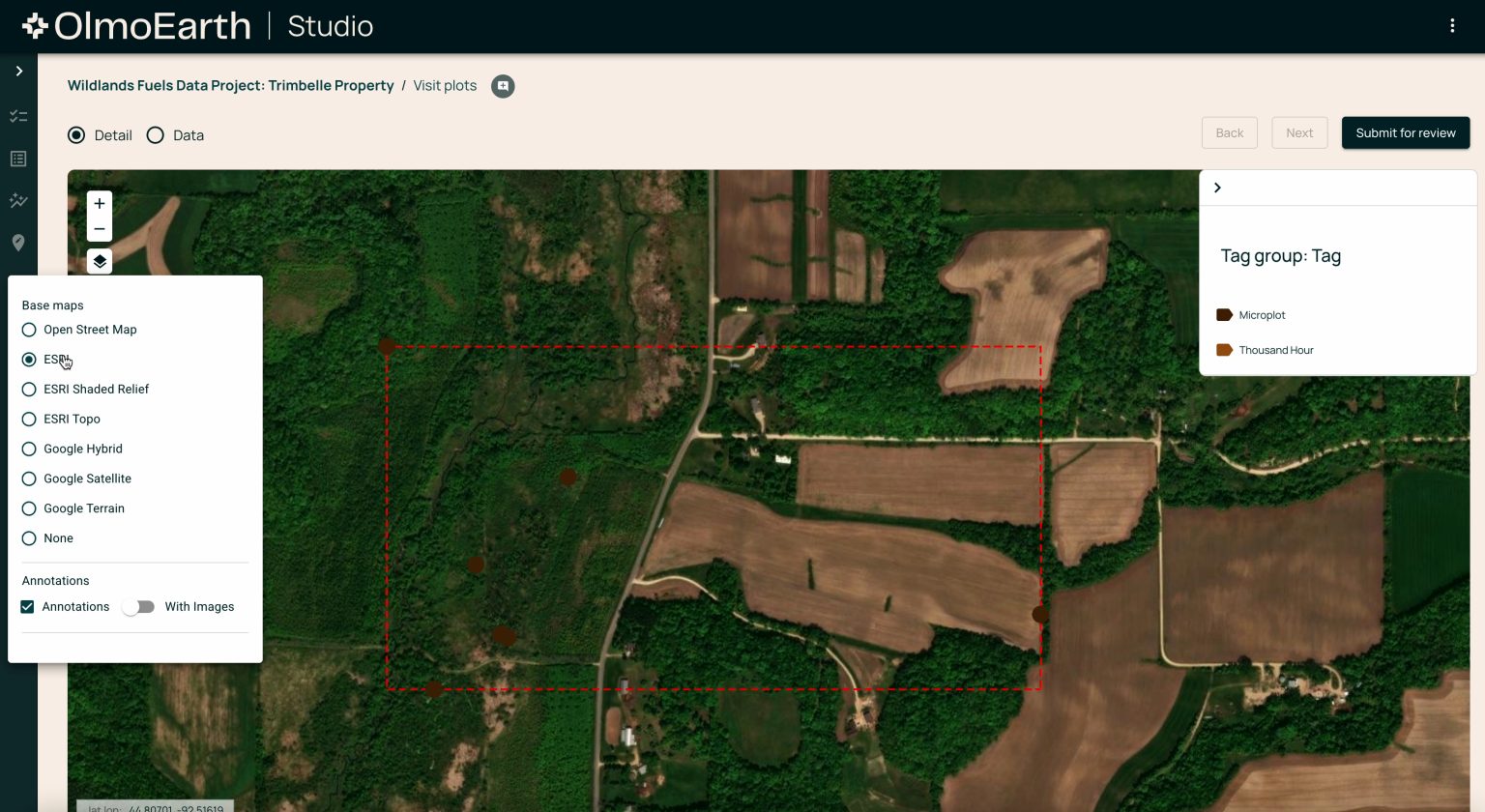
At the core of OlmoEarth are two primary components designed to make environmental AI accessible and practical. The first is OlmoEarth Studio, a specialized workspace where users can create custom datasets and fine-tune AI models for their specific environmental monitoring needs. The second component, OlmoEarth Viewer, provides a web-based interface for exploring AI-generated maps and visualizations of environmental data. These tools are powered by a new family of AI models that Ai2 has trained on an impressive dataset—millions of Earth observations totaling approximately 10 terabytes. By making these sophisticated capabilities available at no cost, Ai2 is essentially providing smaller organizations, researchers, and conservationists with powerful tools previously beyond their reach. Ali Farhadi, Ai2’s CEO and a University of Washington professor, emphasized this democratizing aspect, noting that OlmoEarth is “making Earth AI accessible to those working on the front lines” of environmental challenges.
The practical impact of OlmoEarth is already becoming evident through early adoption cases. According to Ai2, organizations are using the platform to update global mangrove maps with 97% accuracy at twice the previous speed, detect deforestation throughout the Amazon rainforest, and map vegetation dryness in Oregon to improve wildfire prediction and prevention efforts. These applications demonstrate the platform’s versatility and potential to address diverse environmental challenges. Patrick Beukema, the lead researcher on the OlmoEarth team, highlighted how the project fosters collaboration across scientific and technical disciplines, enabling different groups to work together with shared data and tools. This collaborative approach could prove crucial in addressing complex environmental problems that span multiple domains of expertise and geographical boundaries.
OlmoEarth represents the latest extension of Ai2’s commitment to “true openness” in artificial intelligence development. The Seattle-based nonprofit research institute has previously released open-weight language and multimodal AI models, and OlmoEarth applies this same philosophy to climate science and conservation. This approach stands in contrast to the proprietary nature of many existing geospatial analysis platforms. While systems like Google Earth Engine and Microsoft’s Planetary Computer provide access to vast satellite datasets, they often require significant technical expertise and aren’t fully open-source. Ai2 is positioning OlmoEarth as a comprehensive alternative that not only provides data access but delivers a complete, usable system for model fine-tuning and deployment that organizations can adapt to their specific needs without prohibitive technical barriers.
The technical capabilities of OlmoEarth appear impressive when compared to competing offerings from other major AI labs. In its research documentation, Ai2 claims that fine-tuned OlmoEarth models “outperformed AEF substantially,” referring to Google’s AlphaEarth Foundations, which released “embeddings” rather than the complete open model itself. The institute also reports favorable performance compared to environmental AI models from Meta, IBM, and NASA. This competitive edge suggests that Ai2 has made significant technical advances in applying AI to Earth observation data, potentially setting new standards for accuracy and utility in environmental monitoring tools. The platform’s ability to process both current and historical satellite data provides users with valuable contextual information for tracking changes over time, essential for understanding long-term environmental trends.
While the OlmoEarth Viewer is available immediately, with accompanying code and documentation published on GitHub, the full platform including OlmoEarth Studio is currently being rolled out to select partners. Ai2 is inviting additional collaborations, suggesting a phased approach to ensure the system meets the needs of various stakeholders before wider deployment. This measured rollout reflects the complexity of the technology and the importance of ensuring it works effectively across diverse use cases. As climate change accelerates and environmental pressures increase globally, tools like OlmoEarth that democratize access to sophisticated monitoring capabilities could play a crucial role in coordinating responses to environmental challenges. By making advanced Earth observation AI accessible to organizations of all sizes, Ai2 is potentially accelerating our collective ability to understand and address the rapid changes affecting our planet’s ecosystems, resources, and climate systems.


