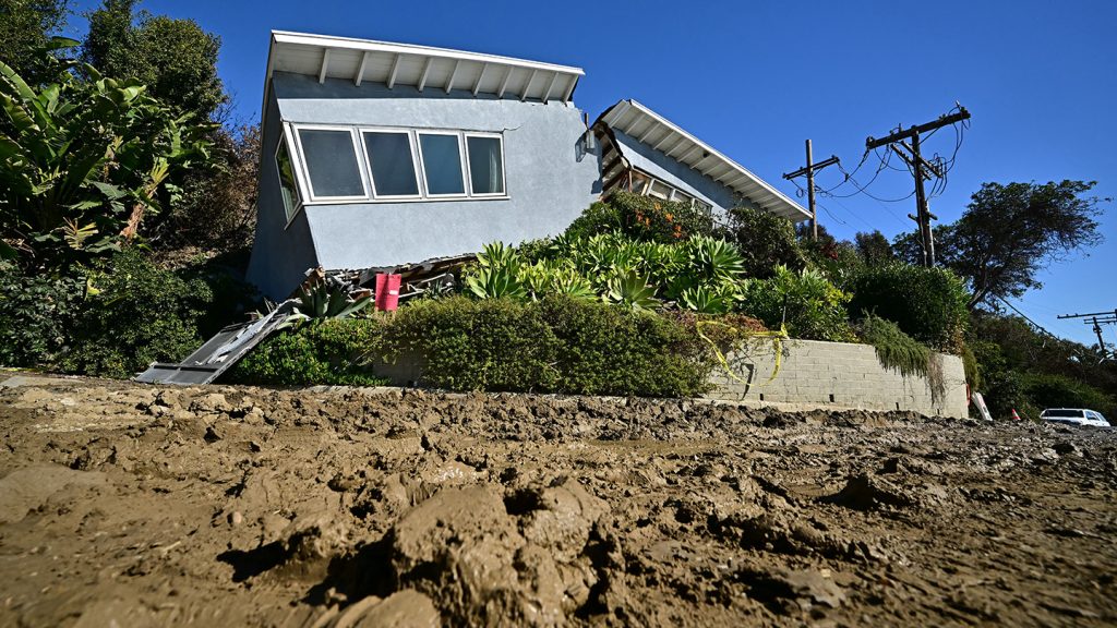
The aftermath of wildfires presents a looming threat beyond the immediate devastation of flames: the potential for catastrophic debris flows. Triggered by intense rainfall, these fast-moving torrents of rock, mud, water, and charred debris surge down scorched slopes with immense destructive power, posing a significant danger to communities in the burn scar areas. Unlike flash floods, debris flows carry a substantial volume of sediment, often mixed with burned trees, boulders, and even vehicles, increasing their height and destructive potential fivefold. The force of these flows can reach speeds of up to 35 miles per hour, capable of carving new paths, overflowing channels, and devastating homes and infrastructure. The 2018 Montecito disaster, where debris flows claimed 23 lives and destroyed over 100 homes just a month after the Thomas fire, serves as a stark reminder of the deadly consequences of this post-fire hazard.
In the wake of the recent Los Angeles wildfires, including the Palisades, Eaton, Kenneth, and Hurst fires, scientists are racing against time to assess the risk of debris flows. The mountainous terrain, steep slopes, and the history of debris flows following previous fires in the region, such as the 2009 Station fire and the 2016 San Gabriel Complex fire, heighten the concern. The assessment process involves a multi-pronged approach, including analyzing satellite imagery to identify changes in vegetation cover and ground conditions. The loss of vegetation due to fire removes the protective layer that shields soil from erosion, weakens the ground by destroying root systems, and creates hydrophobic soil layers that prevent water absorption, all contributing to increased runoff and the likelihood of debris flows.
Field teams venture into the burn scars, equipped with protective gear and communication tools, to verify satellite data and gather soil samples. They focus on areas with moderate to high burn severity, where the majority of litter and near-surface roots have been incinerated. The Eaton fire’s burn scar, with its extremely steep watersheds leading down into populated areas like Altadena, Pasadena, and Monrovia, presents a particularly high risk compared to the Palisades fire area, which has gentler slopes and flows towards the ocean. The presence of hydrophobic soil layers further amplifies the concern in both areas.
The data collected from satellite imagery and field observations are fed into computer programs that generate hazard maps, identifying areas most susceptible to debris flows. These maps, which are publicly accessible, play a crucial role in informing emergency management decisions, including issuing alerts, warnings, and evacuation orders. Meteorologists monitor weather patterns and precipitation forecasts, looking for rainfall intensities that could exceed critical thresholds known to trigger debris flows, such as half an inch of rain in 30 minutes or a quarter of an inch in 15 minutes. While these thresholds don’t guarantee a debris flow, they significantly increase the probability. The National Weather Service (NWS) issues watches and warnings based on these thresholds and real-time rainfall data, urging residents to take precautionary measures.
Emergency managers, in conjunction with city and county officials, use the same data to issue evacuation orders. While evacuations can be disruptive, especially for those already impacted by the fires, they remain the most effective way to protect lives from the unpredictable and swift nature of debris flows. The existence of debris basins and dams in some areas provides a level of protection by capturing debris flowing down the mountains, but these structures are not present in every drainage basin, leaving some communities more vulnerable. Adding to the challenges is the prolonged period of elevated debris flow risk after a fire, which can last from two to five years, depending on the rate of vegetation recovery influenced by precipitation patterns.
Living in fire-prone areas necessitates a heightened awareness of the post-fire risks. Understanding the dynamics of debris flows, recognizing the signs of impending danger, and adhering to evacuation orders are critical for survival. The urgency of the scientific assessments, the vigilance of meteorologists and emergency managers, and the preparedness of residents all play a vital role in mitigating the devastating consequences of this post-fire hazard. The continued dry conditions may delay the return of vegetation, extending the period of vulnerability for communities in the burn scar areas. The cumulative effect of fire and subsequent debris flows highlights the complex and interconnected nature of natural hazards, emphasizing the need for proactive measures, community education, and resilient infrastructure to safeguard lives and property in these vulnerable regions. The lessons learned from past disasters, such as the Montecito debris flows, serve as a crucial guide in shaping future preparedness and response strategies, emphasizing the importance of timely warnings, effective evacuation procedures, and long-term recovery planning.


