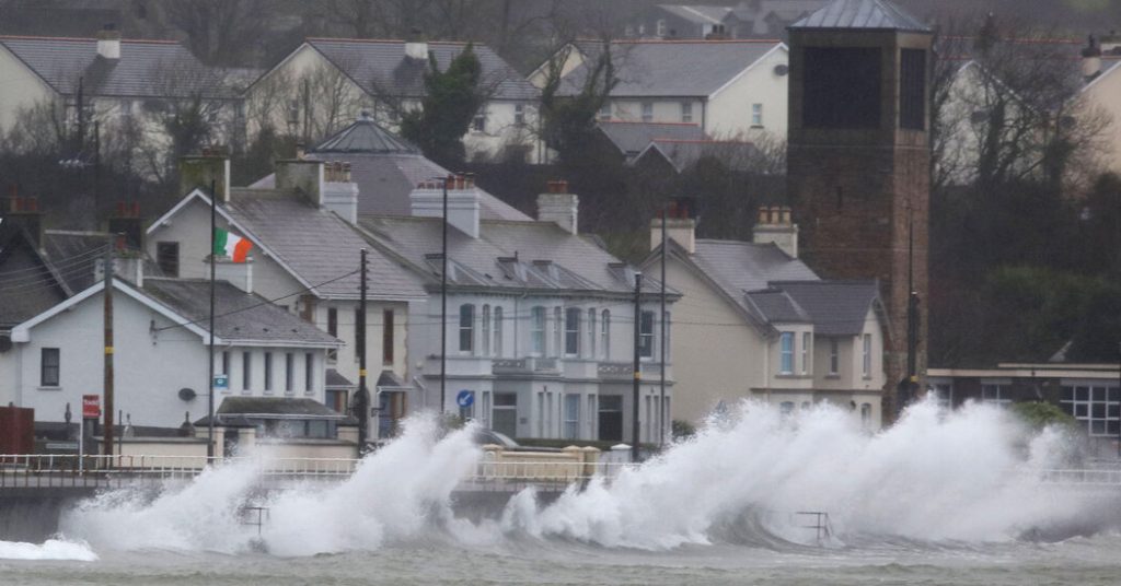
Storm Eowyn, a powerful weather system born from the stark temperature contrast between the arctic blast gripping the United States and the warm, moist air in the Gulf of Mexico, unleashed its fury on Ireland and threatened widespread disruption across Britain on Friday. The storm, fueled by an unusually strong jet stream, delivered record-breaking winds, widespread power outages, and travel disruptions, marking a dramatic conclusion to a week of extreme weather events across the Northern Hemisphere. The storm’s intensity prompted the highest level weather warnings, signifying a potential threat to life and property.
Eowyn’s impact was immediately felt in Ireland, where a gust of 114 miles per hour was recorded at Mace Head, County Galway, shattering a national record that had stood for 78 years. The ferocious winds wreaked havoc on the country’s power grid, leaving over 560,000 customers, nearly a quarter of the nation, without electricity. ESB Networks, the state-owned power company, described the winds as “extreme, damaging, and destructive,” highlighting the significant impact of the storm on critical infrastructure. Even the ability to monitor the storm’s intensity was compromised, as several weather stations were knocked offline by the extreme conditions.
The storm’s trajectory then targeted Britain, with forecasters predicting damaging gales across Northern Ireland, Scotland, England, and Wales. Wind gusts of 60 to 70 miles per hour were widespread, with the potential for gusts exceeding 100 miles per hour in exposed coastal and hilly areas. The Met Office, the United Kingdom’s national weather service, issued its most severe red wind warnings, a rarity reserved for life-threatening weather conditions, for Northern Ireland and parts of Scotland. This marked the first red wind warning for Northern Ireland since the Met Office adopted impact-based warnings in 2011, underscoring the severity of the anticipated conditions.
The intensity of Storm Eowyn was attributed to the unusually strong jet stream, a fast-flowing air current high in the atmosphere that significantly influences weather patterns. The jet stream, typically around 190 to 220 miles per hour, was clocked at approximately 260 miles per hour this week, a significant increase that fueled Eowyn’s rapid intensification as it crossed the Atlantic. This amplified strength propelled the storm towards Britain and Ireland with heightened ferocity, reminiscent of Storm Darragh in early December, which also resulted from a powerful jet stream and brought wind speeds of up to 93 miles per hour to Wales.
The unusually strong jet stream was a consequence of the stark temperature difference between the frigid air mass over the United States and the warmer air over the Gulf of Mexico. This contrast intensified the jet stream, accelerating its speed and contributing to the development of powerful storms like Eowyn. The same jet stream also affected trans-Atlantic flights, with one flight reaching a ground speed of 814 miles per hour, close to the subsonic speed record, highlighting the power and reach of this atmospheric phenomenon.
While Storm Eowyn is expected to move into the Norwegian Sea by Saturday, providing a temporary reprieve with calmer conditions, another storm system is forecast to bring similar hazardous weather to Britain on Sunday and Monday. This emphasizes the volatile weather conditions prevailing over the North Atlantic and the ongoing potential for disruptive storms. The naming of Storm Eowyn, a practice initiated in 2015 by the Met Office in collaboration with Met Éireann and the Royal Netherlands Meteorological Institute, underscores the significance and potential impact of these powerful weather systems. The name, chosen by the Dutch weather service from public suggestions, serves as a stark reminder of nature’s power and the need for preparedness in the face of such extreme events.


