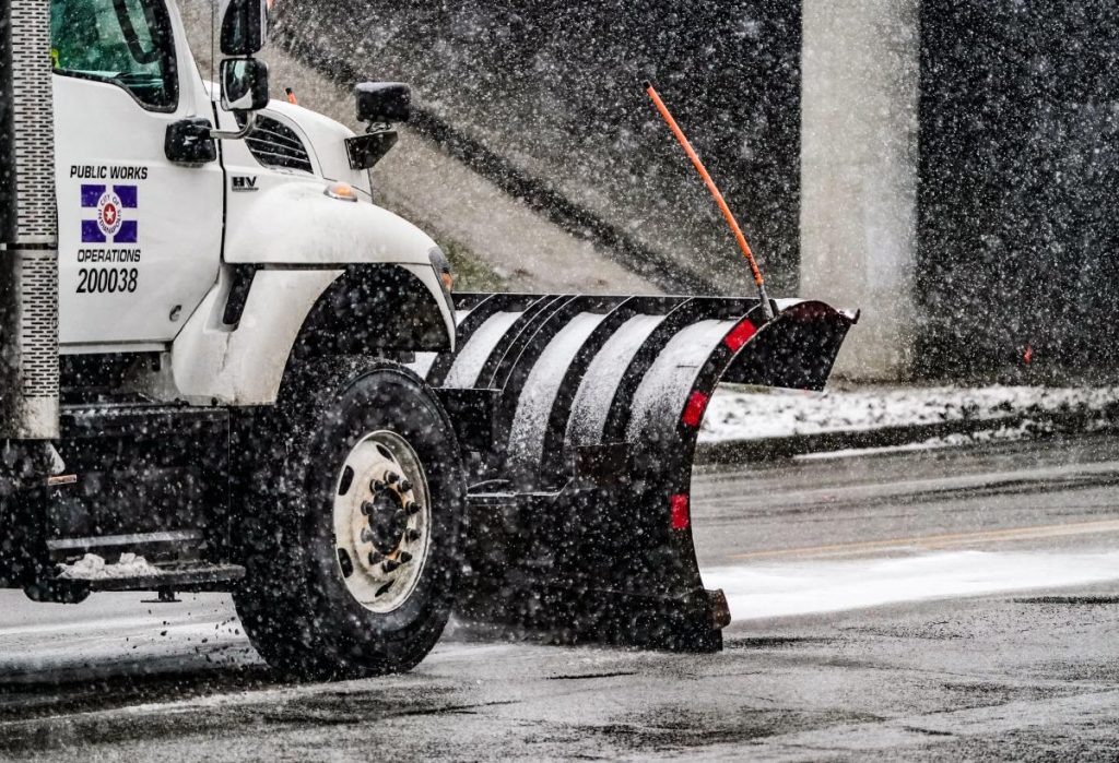
Winter’s icy grip has firmly taken hold of central Indiana, with Tuesday and Wednesday projected to be the coldest days of the week. The season’s frosty greeting is marked by light snow that continues to blanket parts of the region, posing minor yet impactful travel challenges. According to the National Weather Service (NWS) for Indianapolis, these snow showers, although light, could reduce visibility and create slick roads, so drivers should remain cautious during their morning and afternoon commutes.
Snow Showers & Travel Precautions in Indianapolis
Early Tuesday saw snowflakes drifting down, culminating in modest accumulations. The snowfall is expected to persist until approximately 10 a.m. Though central Indiana, specifically Indianapolis, is poised to receive less than half an inch of accumulation, that’s enough to make roads treacherous. The NWS has advised travelers to brace for slower journeys with slick spots on the roads. This could mean longer drive times and an overall need for heightened vigilance while behind the wheel.
Accompanying the snow showers is a sharp drop in temperatures, setting the stage for a night of bone-chilling cold. Lows are forecasted between 0 and -5 degrees across most of central Indiana. Wind chills will make the air feel even more severe, potentially plunging temperatures to an icy -15. These bitter cold conditions extend into Wednesday morning, emphasizing the need for extra measures to stay warm and safe.
Residents are encouraged to don several layers of clothing when venturing outdoors and to ensure their pets have warm, cozy shelter indoors. Central Indiana’s residents know winter can be unforgiving, and this week is living up to those expectations.
A Glimpse at Indianapolis Weather Over the Week
The weather forecast for the week ahead offers a balance between freezing lows and slowly rising daytime temperatures. Let’s break it down day by day:
Tuesday, Jan. 14
Snow is the big story early in the morning, although sunshine is expected to peek through later in the day. Meteorologists predict a daytime high of 22 degrees, supported by winds breezing through at 10 to 20 mph. Snow accumulation on Tuesday is expected to remain under an inch, with a 60% chance of precipitation. As night falls, the skies will clear, and temperatures will plummet, bottoming out at a frigid two degrees.
Wednesday, Jan. 15
After enduring Tuesday’s snow and chill, Wednesday promises a quieter, sunnier day. The high temperature will maintain a wintry tone at 22 degrees. Come evening, Indianapolis will dip down to 14 degrees under partly cloudy skies, offering a slight reprieve from the extreme cold earlier in the week.
Thursday, Jan. 16
On Thursday, cloud cover will dominate the sky, giving us a typical January winter day. Temperatures will edge higher, reaching a much-welcomed high of 37 degrees. As night sets in, fewer clouds are expected, and the temperature will slide down to a manageable low of 25 degrees.
Friday, Jan. 17
Friday brings a slightly warmer yet unsettled forecast. While the daytime high is projected to hit 46 degrees, scattered clouds may intermittently give way to brief moments of sunshine. The forecast also hints at a slight chance of rain during the day, increasing to a 70% likelihood by evening. As darkness falls, occasional light rain is expected. Accompanied by the warming trend, nighttime temperatures will level off at 36 degrees.
Snow Accumulation: How Much Has Central Indiana Seen So Far?
As we endure this wintry stretch, Indianapolis residents might be wondering how this year’s snowfall measures up. So far, the city has recorded 15.7 inches of snow this season, most of which arrived on the heels of the major snowstorm that swept through on January 5 and 6. An additional 3.5 inches of snow graced the city between Friday night and early Saturday.
However, Indianapolis is not the only part of the state measuring snow totals. Down in southeastern Indiana, near the Ohio River, the snowfall tally sits at an even more impressive 22.4 inches. In South Bend, known for its lake-effect snow that typically boosts its seasonal average to 64.5 inches, this winter has been relatively tame, with only 14.8 inches having fallen thus far.
The prolonged stretch of freezing temperatures this month has added to the season’s challenges. According to the NWS, Indianapolis didn’t experience a temperature above freezing for a staggering 222 hours prior to Sunday. That’s over nine consecutive days of subfreezing conditions, reinforcing just how brutally cold this January has been.
Looking Ahead: More Snow and Bitter Cold on the Horizon?
While the forecast for the rest of this week gradually introduces milder weather, forecasters caution that central Indiana may not be out of the woods just yet. Another powerful winter storm is brewing on the horizon and could bring more significant snowfall to the region next weekend. This storm, combined with continued frigid air, may send central Indiana back into the subzero temperature range before the week’s end.
Winter warriors across Indianapolis and beyond are encouraged to stay tuned to the latest updates from the NWS as this forecast unfolds. Preparedness and caution remain key in facing these harsh conditions.
Quick Tips to Stay Safe Amid Winter Weather
As central Indiana embraces these frosty days, it’s crucial to be vigilant and prepared for the challenges winter weather presents. Here are some essential tips to navigate the cold safely:
-
Layer Your Clothing: Dressing in multiple layers keeps your body heat insulated better than a single thick garment. Don’t forget gloves, hats, and scarves to protect extremities vulnerable to frostbite.
-
Precautionary Travel Measures: Roads slick from snow can be hazardous. Reduce your speed, allow plenty of stopping distance, and ensure your vehicle is equipped with proper winter tires, emergency supplies, and a full tank of gas.
-
Bring Pets Indoors: Subzero conditions are dangerous not only for people but also for pets. Avoid leaving animals outside for extended periods, and provide them with a warm, comfortable shelter.
-
Prepare for Power Outages: During extreme winter conditions, power outages are not uncommon. Be prepared with emergency supplies, such as blankets, flashlights, batteries, and non-perishable food items.
- Stay Informed: Weather conditions can change rapidly, especially during winter storms. Keep an eye on updates from trusted sources like the NWS or local weather outlets.
Final Thoughts
Winter in Indianapolis isn’t for the faint of heart, and this week’s weather serves as a stark reminder of just how relentless the season can be. From the snowfall impact on Tuesday to the biting cold forecasted through Wednesday, central Indiana finds itself in the thick of it. While temperatures may edge higher toward the end of the week, the possibility of another significant storm looms large.
Whether you’re a winter enthusiast or someone who prefers warmer days, staying aware, prepared, and safe is the name of the game. Embrace the beauty of the season when possible—but don’t forget to bundle up! If venturing out into the snow and cold isn’t necessary, there’s no better time to grab a warm drink and enjoy the comfort of staying indoors.
For now, keep your winter gear handy, drive safe, and keep an eye on updated forecasts. And if you’re counting down the days until spring, remember—Indiana’s unpredictable weather always has surprises in store.


