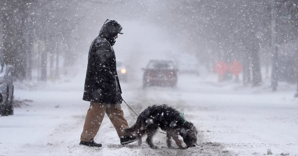
A powerful winter storm swept across the United States, initially pummeling the Midwest with blizzards and freezing rain before transitioning to the Mid-Atlantic region, leaving a trail of disruption, power outages, and hazardous travel conditions in its wake. The storm delivered record-breaking snowfall in parts of Kansas and Missouri, blanketing cities like Kansas City and Topeka with over a foot of snow in a single day. The heavy snow, coupled with strong winds and treacherous ice, resulted in numerous vehicle accidents, including overturned tractor-trailers and pileups on major interstates, forcing residents to hunker down indoors and bringing daily life to a standstill. The impact on infrastructure was significant, with hundreds of thousands of people losing power across multiple states.
The storm’s eastward progression brought a new wave of concern to the Mid-Atlantic, where moderate to heavy snow and freezing rain were anticipated from West Virginia to Delaware, including the Washington D.C. metro area. Forecasters warned of dangerous and potentially impossible driving conditions, urging residents to avoid travel and prepare for significant disruptions. The heavy snowfall predictions, ranging from six to twelve inches in some areas, prompted several states, including Arkansas, Kansas, Kentucky, Missouri, Virginia, West Virginia, Maryland, and parts of New Jersey, to declare states of emergency, facilitating a more coordinated and effective response to the storm’s impact.
As the storm continued its eastward march, the Mid-Atlantic region braced for the brunt of its impact. The morning commute in cities like Pittsburgh was already being disrupted by snowfall, and the forecast predicted continued disruptions throughout the day and into the evening. The Weather Prediction Center highlighted the potential for significant travel difficulties across the impacted region, emphasizing the dangerous driving conditions caused by heavy snow and ice accumulation. In addition to the snowfall, areas further south faced the threat of sleet and freezing rain, with northern Kentucky and parts of southern West Virginia expected to experience significant ice buildup, raising concerns about power outages and hazardous travel conditions.
The widespread power outages resulting from the storm added another layer of complexity to the already challenging situation. Tens of thousands of customers were without power across multiple states, including Kentucky and Indiana, as the storm knocked down power lines and overwhelmed electrical grids. The combination of heavy snow, ice, and strong winds made it difficult for utility crews to quickly restore power, leaving many residents in the dark and cold. The power outages underscored the far-reaching impact of the storm and the challenges faced by communities in coping with its aftermath.
Beyond the immediate impact of the heavy snow and ice, the storm also brought a wave of frigid temperatures across a wide swath of the country. The Weather Prediction Center warned of nighttime temperatures plunging into the single digits and even below zero across the Central Plains, Mississippi Valley, and Ohio Valley. Daytime highs were expected to remain below freezing in these areas, while the Mid-Atlantic region faced slightly less extreme cold, with temperatures hovering near freezing. The prolonged cold snap added to the challenges posed by the storm, particularly for those without power or adequate heating.
In the days following the storm, while the snow was expected to taper off, the cold weather was predicted to linger, with temperatures significantly below seasonal averages across a vast area from the eastern Rockies to the East Coast. This extended period of cold temperatures further complicated recovery efforts and posed continued challenges for residents struggling to cope with the storm’s aftermath. The combination of heavy snow, ice, widespread power outages, and prolonged cold temperatures highlighted the significant disruption caused by this major winter storm and the importance of preparedness and community support in weathering such extreme weather events.


