Holiday Travel Forecast: A Mixed Bag of Weather Conditions Across the US
Millions of Americans embarking on Christmas journeys face the prospect of inclement weather disrupting their festive plans. While no major storms are anticipated, periods of rain and winter weather are expected to impede holiday travel, particularly in the eastern United States. AAA projects a record-breaking 120 million travelers for the Christmas period, increasing the potential impact of weather-related delays and disruptions. The western US and southern Plains will experience the brunt of the inclement weather, while a brief cold snap will sweep across the Northeast. Conversely, the central and eastern US are predicted to enjoy more pleasant weather, with only light rain anticipated in cities like Atlanta and Chicago. This fairer weather is expected to facilitate smoother travel on Wednesday.
Northeast Braces for Christmas Eve Snow
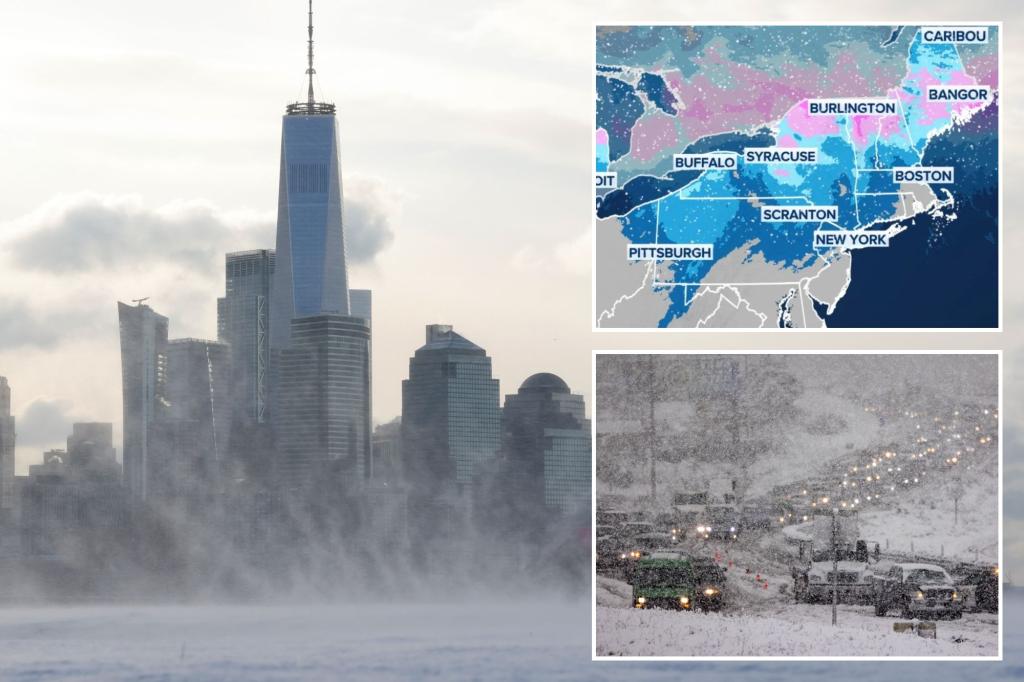
The Northeast experienced snowfall over the weekend, affecting major travel arteries like Interstate 95 from Philadelphia to Boston. This caused slippery road conditions during what is traditionally one of the busiest travel times of the year. Eastern Massachusetts, Rhode Island, and eastern Connecticut saw accumulations of 3-6 inches of snow, with Boston’s Logan Airport recording 5.2 inches and Fenway Park receiving a full 6 inches. This snowfall marked Boston’s largest accumulation since the January 2022 blizzard. Another snow-producing system is forecast to move through similar areas in the Northeast leading up to Christmas Eve. This system, originating in the Great Lakes, will bring light to moderate snow across Wisconsin and Michigan before reaching the interior Northeast and parts of New England overnight and into Tuesday morning. Winter Weather Advisories have been issued from Wisconsin to Maine, and in parts of the mid-Atlantic from West Virginia to New Jersey, including Washington, Baltimore, and Philadelphia. These alerts warn of freezing rain, sleet, and light snow, potentially creating icy road conditions on Tuesday morning. Fortunately, the snow and wintry mix are expected to diminish quickly from west to east on Christmas Eve, minimizing travel disruptions for those on the road later in the day.
West Coast Faces Relentless Rain and Mountain Snow
The West Coast is preparing for a series of storms impacting the West and Northwest throughout the week. While these individual storms are expected to be weak to moderate through Christmas Day, the extended period of windy and unsettled conditions will persist after the holiday, potentially affecting return trips. Moderate to heavy rain is anticipated from San Francisco to Seattle, raising concerns about flash flooding. Through Tuesday, parts of Northern California and coastal Oregon could see up to 6 inches of rain, potentially causing flight delays at Seattle-Tacoma International Airport and San Francisco Bay Area airports. High snow levels mean significant snowfall will be largely confined to the Cascade Mountains, the northern Sierra Nevada, and the northern Rockies, where several feet of accumulation are possible. Another heavier round of rain and mountain snow is expected on Christmas Day itself, likely causing travel issues for those attending holiday gatherings.
Thunderstorms and Potential Flooding in the South
A developing storm system is predicted to draw moisture from the Gulf of Mexico on Monday, triggering scattered showers and thunderstorms from Texas into southern Missouri. The chance of rain persists through Christmas Eve, with the Ark-La-Tex region potentially receiving 2-3 inches of rainfall. Some thunderstorms could be strong to severe, bringing gusty winds, lightning, and heavy downpours. Rainfall rates exceeding an inch per hour could lead to localized flash flooding, although the rain will generally be welcomed in a region grappling with drought conditions.
End-of-Year Warmup Predicted Across Much of the US
A significant end-of-year warmup is anticipated across much of the US, shifting from frigid temperatures to unusually mild conditions. Forecast models suggest a strong Pacific jet stream will develop around Christmas, driving warmer-than-average air into the Lower 48 and potentially leading to a more active storm track. NOAA’s Climate Prediction Center forecasts above-average temperatures for nearly the entire Lower 48 in the week after Christmas, with near or above-average precipitation for most areas except parts of the Southwest and south-central US. High temperatures are projected to climb 10-20 degrees above average, with over 200 million people potentially experiencing the warmth in early 2025.
Travel Recommendations and Considerations
Given the varied weather conditions across the country, travelers are advised to check forecasts regularly and adjust their plans accordingly. Those in the Northeast should be prepared for winter driving conditions, particularly on Christmas Eve morning. West Coast travelers should anticipate delays due to rain and mountain snow, while those in the South should be mindful of the potential for thunderstorms and flooding. Flexible travel plans and awareness of local weather advisories will be crucial for a safe and enjoyable holiday journey. Monitor official weather sources and consider alternative routes or modes of transportation if necessary. Allow extra time for travel and pack accordingly for varying weather conditions. Staying informed and prepared will minimize the impact of weather-related disruptions and ensure a smoother holiday travel experience.


