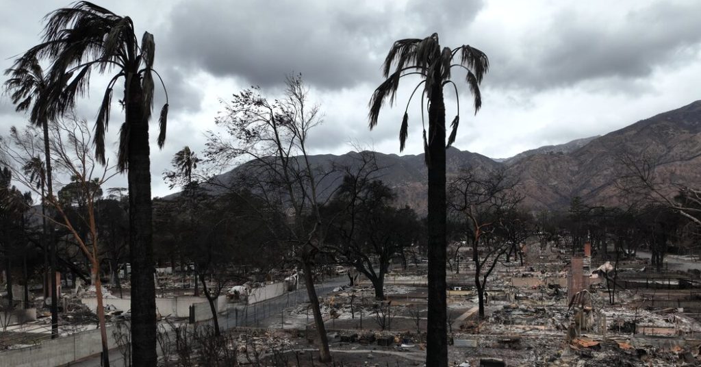
A slow-moving rainstorm system offered a mixed blessing to Southern California on Sunday, delivering much-needed relief from a protracted dry spell while simultaneously raising concerns about mudslides in areas recently ravaged by wildfires. The region, parched by the driest start to a rainy season on record in Los Angeles, welcomed the showers that promised to dampen fire risks and revitalize desiccated vegetation. However, the National Weather Service issued warnings about the potential for significant mudslides in several Los Angeles County burn scars, where the charred earth, unable to absorb water, posed a high risk of runoff and debris flows.
The rain, expected to continue into Monday afternoon, presented a complex challenge: quenching the thirst of a drought-stricken land while simultaneously threatening areas made vulnerable by recent fires. The delicate balance between relief and risk underscored the precarious state of the region’s ecosystem, highlighting the interconnectedness of weather patterns and the lingering consequences of natural disasters. The forecast predicted light rain across the region interspersed with heavier bursts, with total rainfall anticipated to reach up to an inch in Los Angeles and Ventura Counties and up to three inches in the surrounding mountains.
The primary concern centered on the burn scars left by multiple wildfires that had scorched thousands of acres across Southern California earlier in the month. These areas, stripped bare of vegetation, presented a heightened risk of mudslides due to the soil’s inability to absorb water. The charred earth, rendered hydrophobic by the intense heat of the fires, would repel water, leading to rapid runoff and the potential for devastating mudslides. The National Weather Service estimated a 10 to 20 percent chance of significant mudslides in several Los Angeles County burn scars, emphasizing the need for vigilance and preparedness.
Several burn scars within Los Angeles County were identified as particularly vulnerable, including areas impacted by the Palisades fire in the Pacific Palisades, the Hurst fire near Sylmar, the Sunset fire near West Hollywood, the Eaton fire near Pasadena, the Hughes fire near Castaic Lake, and the Franklin fire near Malibu. These locations, having recently experienced the destructive power of fire, now faced a new threat from the life-giving rain. Outside Los Angeles County, the risk of mudslides was slightly lower, estimated at 5 to 10 percent.
The period of highest rainfall intensity was predicted to occur between 4 p.m. Sunday and 4 p.m. Monday, a crucial window during which the potential for mudslides would be greatest. Rainfall rates exceeding half an inch per hour in the burn scars were deemed particularly concerning, capable of triggering significant issues. Authorities urged residents to prepare by stocking up on supplies and protecting their properties with sandbags. A flood watch was issued for Los Angeles County, extending until Monday afternoon.
The arrival of the rain marked a significant shift in the region’s weather patterns, bringing an end to a prolonged dry spell that had fueled the devastating wildfires earlier in the month. Prior to Saturday, downtown Los Angeles had experienced no measurable rainfall this year, underscoring the severity of the drought. The rain was welcomed as a much-needed reprieve, offering hope for improved fire conditions and the revitalization of parched vegetation. However, the accompanying risk of mudslides served as a stark reminder of the complex interplay between natural forces and the lasting impact of environmental disasters. The rain, while beneficial in many ways, carried the potential for further disruption and damage in areas already scarred by fire.


