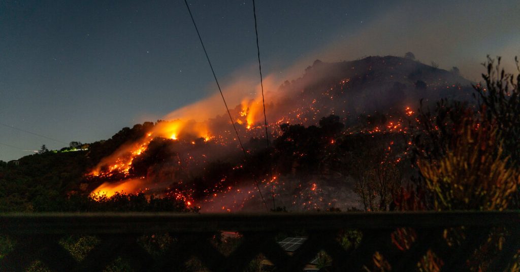
Southern California braces for a critical fire weather threat as powerful Santa Ana winds are forecast to descend upon the region, exacerbating already perilous conditions. These dry, downslope winds, notorious for fanning wildfires, are expected to peak in intensity Monday night into Tuesday morning, creating an environment ripe for rapid fire spread. The predicted wind strength rivals that of the destructive gusts earlier this month, which fueled devastating wildfires in Altadena and Pacific Palisades, underscoring the gravity of the situation. While the earlier winds primarily impacted areas with a north-to-northeast trajectory, the upcoming event is projected to affect locations with a more northeast-to-east orientation, particularly the San Fernando and Santa Clarita Valleys, the Los Angeles County mountains and foothills, and much of Ventura County. Adding to the danger, the strong winds are likely to topple trees, disrupt power supplies, and create hazardous ocean conditions.
The anticipated Santa Ana winds pose an extreme fire danger due to the region’s prolonged drought and the resulting abundance of dry vegetation. Months of scant rainfall have left the landscape parched and highly flammable, creating a tinderbox-like scenario. The persistent offshore wind pattern will further desiccate the vegetation, stripping it of any remaining moisture and pushing relative humidity levels into the single digits, a recipe for explosive fire growth. The lack of significant rainfall since spring has left grasses and brush withered and extremely susceptible to ignition. This dire situation is highlighted by the historically low rainfall recorded in Downtown Los Angeles, a key indicator of regional precipitation, which is on track to be the lowest amount ever measured between May and January since record-keeping began in 1877.
The combination of powerful Santa Ana winds, bone-dry vegetation, and extremely low humidity creates a volatile mix that significantly elevates the fire risk. Experts emphasize the critical need to avoid any new ignitions during this period, as even small sparks could rapidly escalate into major conflagrations. With the landscape already primed to burn due to the extended drought, the incoming winds add a dangerous element that could easily overwhelm fire suppression efforts. The sheer volume of dry fuel, coupled with the wind’s ability to quickly spread embers, makes the situation incredibly precarious. Fire officials are on high alert and urging residents to take all necessary precautions to prevent fire starts.
The Santa Ana winds, a common winter phenomenon in Southern California, originate in the high deserts of Nevada and Utah. As these dry air masses descend the slopes of the Transverse Ranges, they compress and accelerate, creating powerful gusts that can exceed 80 miles per hour in mountainous areas and foothills. The winds are expected to primarily impact northern and western Los Angeles County and much of Ventura County. Coastal and valley areas are forecast to experience gusts of 45 to 65 mph, while isolated gusts of up to 80 mph are possible in higher elevations. The combination of high winds, warm temperatures in the high 60s to low 70s, and critically low humidity levels on Tuesday further intensifies the fire danger.
Recognizing the severity of the threat, the National Weather Service has issued a red flag warning, indicating critical fire weather conditions, from Monday morning through Tuesday evening for portions of Los Angeles and Ventura Counties. A less severe fire weather watch is in effect from Tuesday evening through Thursday evening, as winds are expected to calm slightly midweek before potentially picking up again Thursday night into Friday. The red flag warning signifies the extreme fire danger and serves as a crucial alert to residents and fire agencies. Given the potential for isolated gusts approaching hurricane force, the Weather Service may issue a “particularly dangerous situation” designation, similar to the warning issued earlier this month when winds exceeded 90 mph.
While the immediate forecast presents a significant fire threat, the long-term outlook offers little relief. The absence of rainfall in January, coupled with only a slight chance of lighter-than-needed precipitation at the end of the month, further deepens concerns about the ongoing fire season. Experts warn that the lack of substantial rainfall will continue to exacerbate the dry conditions, prolonging the fire danger well into the future. The region desperately needs significant precipitation – at least two inches – to meaningfully reduce the fire risk, a benchmark that appears unlikely to be met in the near term. This continued dry spell underscores the importance of vigilance and preparedness in the face of an extended fire season.


