


The Digital Revival of Ancient Roman Roads: A Journey Through Time
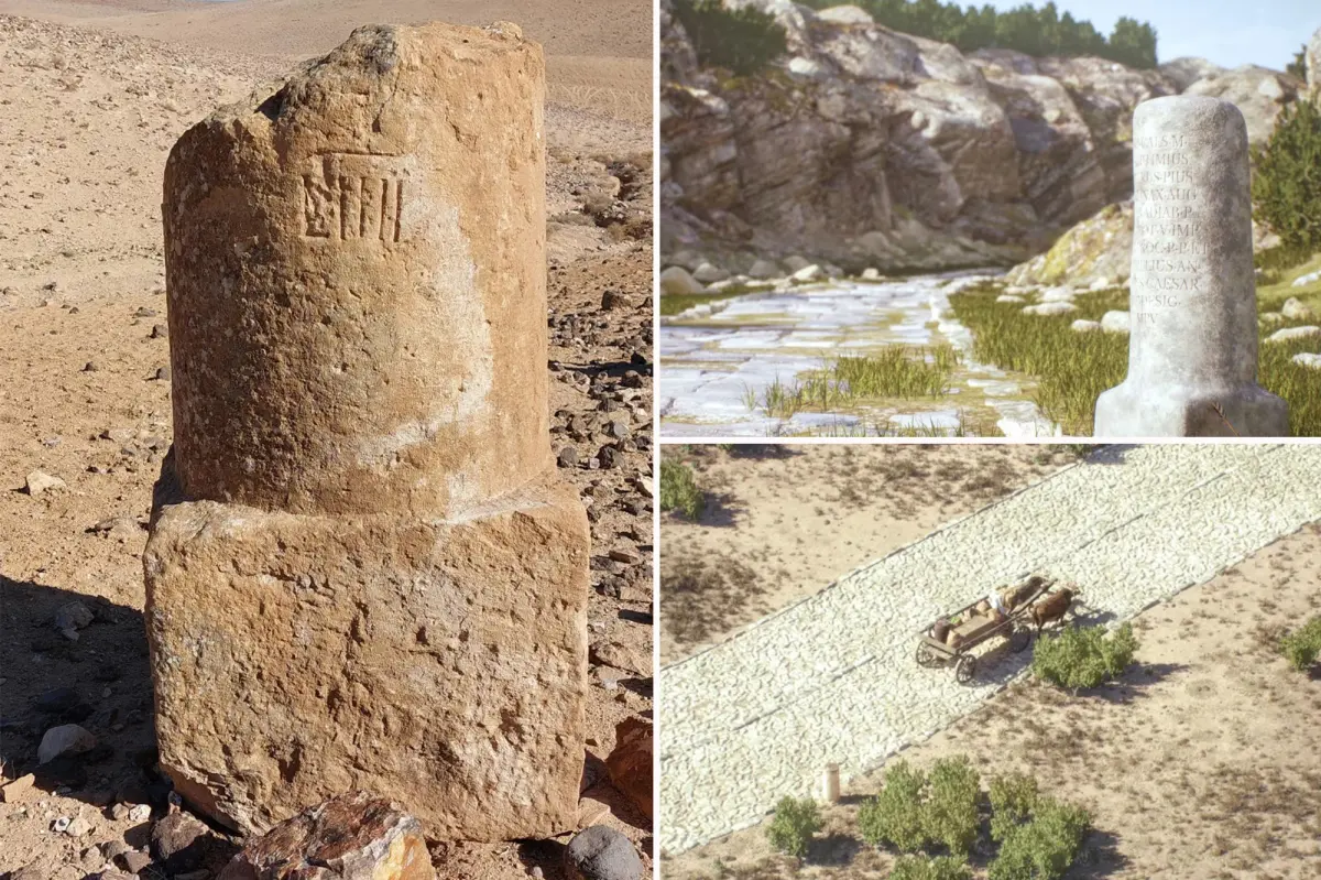
Rome’s influence on our modern world extends far beyond the occasional thoughts men admit to having about the ancient empire. Recently, these contemplations have gained new substance through Itiner-e, an innovative digital visualization tool that resurrects the sprawling network of Roman roads that once connected Europe, the Near East, and North Africa. Aptly described by archaeologist Tom Brughmans of Aarhus University in Denmark as “Google Maps for Roman roads,” this interactive digital atlas represents a culmination of 200 years of archaeological research and scholarship. The project stands as a testament to Rome’s engineering prowess and offers contemporary users a chance to visualize how people, goods, and ideas traversed the ancient world’s most sophisticated transportation network.
This digital roadmap encompasses an astonishing 300,000 kilometers (approximately 186,000 miles) of Roman thoroughfares, providing an unprecedented visualization of the empire’s connective tissue. What makes Itiner-e particularly valuable is its collaborative nature – Brughmans emphasizes that it serves as “a growing resource for a community to keep on adding information,” ensuring it continually evolves to represent the most accurate collective knowledge of the Roman road system. This collaborative approach acknowledges both the vastness of the subject and the ongoing nature of archaeological discovery. While the visualization is impressive in its scope, the researchers are transparent about its limitations – approximately 90% of the mapped roads lack precise geographical certainty, and 7% are hypothesized based on archaeological evidence rather than confirmed locations. These limitations reflect the challenges inherent in reconstructing ancient infrastructure across territories that have undergone two millennia of development and change.
When users engage with the interactive map, they are transported back 2,000 years to a time when wooden chariots and horse-drawn carriages served as the primary vehicles for transporting food, wine, people, and military equipment across the empire. This visualization does more than simply display roads; it offers insights into the practical realities of ancient travel and commerce. Dr. Catherine Fletcher of Manchester Metropolitan University notes that the dataset “brings together a huge range of research to give a bigger and more comprehensive picture of the Roman road network than we’ve had before.” This comprehensive approach allows users to understand not just where roads were located, but how they functioned as conduits for cultural exchange, economic activity, and even the spread of infectious diseases throughout the empire’s diverse territories.
The famous adage “When in Rome, do as the Romans do” takes on new meaning when we consider how the empire’s transportation infrastructure shaped and standardized experiences across vast territories. The Romans didn’t merely build roads; they created a system that fundamentally altered how people related to distance, time, and cultural exchange. These roads allowed for unprecedented movement of goods and people, creating connections between distant provinces that would have been unimaginable in earlier eras. The digital visualization helps modern users comprehend how this network facilitated Rome’s ability to maintain control over diverse territories spanning three continents. The project illuminates how ideas, customs, and practices could spread relatively quickly through this sophisticated transportation network, contributing to cultural standardization while still accommodating regional variations.
What makes the Itiner-e project particularly relevant today is how it connects to our contemporary fascination with the Roman Empire, which emerged as a surprising social media trend several years ago when men admitted to thinking about Rome with surprising frequency. This fascination typically centers on the empire’s vast territorial reach, architectural marvels, and advanced infrastructure – precisely the elements that the digital road map brings into sharper focus. The visualization tool provides substance to these reflections, offering a tangible way to engage with Rome’s engineering achievements. Rather than relegating Roman roads to abstract historical concepts, Itiner-e renders them visually accessible, allowing users to trace routes that connected communities across thousands of miles and shaped the movement of people and goods for centuries.
The researchers behind Itiner-e hope that beyond satisfying historical curiosity, the tool will provide valuable insights into fundamental aspects of human civilization – specifically, how transportation networks influence the spread of ideas, cultural practices, and even diseases. By understanding how Romans moved through their world, we gain perspective on our own highly connected global civilization. The project invites us to consider parallels between ancient and modern transportation systems, while recognizing the profound differences in scale and speed. Just as Roman roads once represented the height of human engineering and transformed connections between distant communities, our modern transportation and communication networks continue this tradition of shrinking distances and facilitating exchange. Itiner-e thus serves not only as a window into the past but as a mirror reflecting our enduring human drive to connect, exchange, and traverse the spaces between us – a drive that has shaped civilizations from ancient Rome to our digital present.


