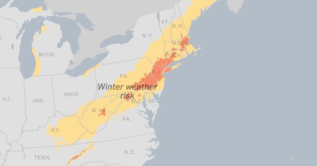
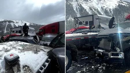
A significant winter storm impacted the Mid-Atlantic and Northeast regions on Sunday, bringing heavy snowfall and setting the stage for a wave of dangerously low temperatures across much of the United States. The storm, predicted to deliver the coldest weather in years for many areas, concentrated its heaviest snowfall north and west of the I-95 corridor, with accumulations reaching up to eight inches. Preliminary reports indicated significant snowfall in West Virginia, while lighter amounts were observed from Kentucky to Massachusetts. The storm provided a picturesque backdrop in Philadelphia, where Eagles players celebrated their victory with snow angels, and in New York City, where a blanket of snow began to cover cars and grassy areas.
The National Weather Service issued winter storm warnings and winter weather advisories across the Northeast, highlighting the potential for hazardous travel conditions. Forecasters in New York reported heavy snowfall rates, reaching one to two inches per hour in some areas, along with instances of thundersnow, a rare phenomenon combining lightning and thunder with snowfall. The New York City metropolitan area, Long Island, and parts of Connecticut were under winter weather advisories, anticipating accumulations of three to five inches, creating slippery roads and challenging driving conditions.
Air travel experienced significant disruptions, with delays and cancellations reported at major airports throughout the Northeast, including New York City, Philadelphia, Boston, and Washington, D.C. Airport crews worked diligently to clear runways of snow and ice. In Washington, D.C., the Department of Transportation preemptively treated roads and urged drivers to stay off the streets in anticipation of the storm and the influx of visitors expected for the upcoming Inauguration Day. Massachusetts reduced speed limits on a portion of I-90 in response to the accumulating snow.
Following the storm’s departure early Monday, a blast of arctic air was forecast to plunge across the south-central and southeastern United States, ushering in several days of frigid temperatures. The National Weather Service emphasized the severity of this cold snap, predicting the lowest temperatures of the season so far, and in many cases, the coldest in several years. High temperatures were expected to range from below zero to single digits in the Northern Plains and Upper Midwest, with progressively warmer conditions further south, reaching the teens and 20s in the Northeast and Mid-Atlantic, and the 20s and 30s in Texas and the Southeast.
The extreme cold raised concerns about dangerously low wind chills, increasing the risk of hypothermia and frostbite with prolonged exposure or inadequate clothing. Wind chills were forecast to plummet to 30 to 55 degrees below zero in the Rockies, northern Plains, and Upper Midwest, and remain subzero as far south as Oklahoma, the Tennessee Valley, and the Ohio Valley. Even before the arctic air arrived, cities like Chicago experienced single-digit temperatures. Residents braced themselves for the deep freeze, with some humorously referring to it as “hibernation season.”
Looking ahead, another winter storm threatened the Gulf Coast states on Monday. The combination of frigid air and a Gulf storm system was expected to bring snow, freezing rain, and ice across the region, potentially causing major travel disruptions. This storm was forecast to track eastward from Texas, impacting Alabama, Georgia, Louisiana, Mississippi, and the Carolinas. The National Weather Service issued winter storm watches for parts of Louisiana, anticipating the heaviest snowfall, potentially four to six inches, between the U.S. 190 and Interstate 10 corridors of Louisiana and southeast Texas. This series of winter storms highlighted the challenges of navigating extreme weather across a wide swathe of the United States.


