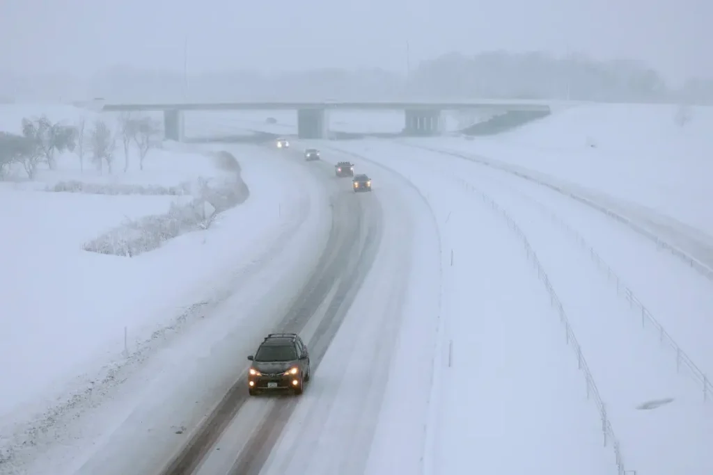
First Snowfall of the Season Sweeps Across Four States
As autumn transitions into winter, the first snowfalls of the season are arriving right on schedule according to climatological averages. This weekend, residents across Wyoming, South Dakota, Minnesota, and Michigan are preparing for snow as the National Weather Service (NWS) has issued multiple winter weather advisories. The incoming cold front that meteorologists have been tracking for days is finally making its presence known, bringing winterlike temperatures to much of the country. AccuWeather senior meteorologist Tom Kines notes that this system is moving across the nation exactly when we would expect the season’s first significant snowfall in these regions.
The snow will begin earliest in Wyoming and South Dakota, with accumulation starting around 4 a.m. local time on Saturday. These states can expect up to 5 inches of snow, particularly in areas above 5,000 feet elevation, including the northern Black Hills in South Dakota and the Wyoming Black Hills. What makes this weather event potentially hazardous isn’t just the snow itself, but the accompanying winds, which could reach speeds of 45 miles per hour. The combination of snow and strong winds will create blowing snow conditions that significantly reduce visibility and make travel difficult. As one NWS Rapid City advisory warns, “Plan on slippery road conditions. Gusty winds could bring down tree branches,” highlighting the multiple hazards residents should prepare for.
By Saturday evening, the snow will spread northeastward into Minnesota and Michigan, with winter weather advisories already in place from the NWS offices in Duluth and Marquette. In Michigan, snowfall is expected to begin around 7 p.m., affecting numerous counties including Delta, Luce, Northern Schoolcraft, Keweenaw, Northern Houghton, Gogebic, Ontonagon, Baraga, Southern Houghton, Alger, and Marquette. Some areas in Michigan could see significant accumulation, with forecasts predicting up to 8 inches of snow. Similarly, in Minnesota, the advisory covers Iron County, including the Tribal Lands of the northwestern area of the Lac du Flambeau Band, with snowfall beginning around 6 p.m. and potentially reaching 8 inches in some locations.
The unique challenge of this weather system in the Great Lakes region is the lake effect snow, which can create dramatically different conditions within short distances. The NWS Marquette office emphasized this variability in their advisory: “During lake effect snow, the weather can vary from bands of locally heavy snow to dry weather just a few miles away. Visibilities can also vary greatly. Be prepared for rapid changes in weather, visibility, and road conditions.” This warning underscores how quickly conditions can deteriorate and the importance of staying alert while traveling. Lake effect snow is notorious for creating isolated bands of intense snowfall while leaving nearby areas relatively untouched, making it particularly challenging to predict exactly who will see the heaviest accumulations.
For residents in these four states, the timing of these advisories means weekend plans may need adjustment. Most winter weather advisories are expected to remain in effect until late Monday morning or afternoon, giving the snow system plenty of time to impact the region. The exception is in South Dakota and Wyoming, where conditions should improve earlier, with advisories set to expire Saturday night. However, the weather situation remains fluid, and the NWS may issue additional advisories throughout the weekend depending on how conditions develop. Residents should stay tuned to local forecasts and be prepared for changing conditions, especially if traveling.
This first significant snow of the season serves as a reminder that winter is approaching, and it’s time for cold-weather preparations. For those in the affected regions, this means ensuring vehicles are equipped with winter emergency kits, checking tire tread and pressure, and reviewing winter driving techniques. Home preparations might include checking heating systems, insulating pipes, and restocking emergency supplies. While the snow accumulations predicted aren’t extreme by midwinter standards, the first snowfall often causes more accidents and disruptions as drivers readjust to winter conditions. As communities across these four states watch the skies turn from rain to snow, this weekend marks a clear transition point in the seasonal calendar – the moment when winter truly begins to make its presence felt across the northern United States.


